Storm Chase Details
Miles Logged: 463
States Chased: OK
Tornadoes Witnessed: 2
Largest Hail Encountered: 1.50 in.

Severe Risks: SPC Outlooks
Severe Reports: Storm Reports
A high-end day in terms of expectations including a SPC high risk upgrade. The first high risk in Oklahoma since May 20, 2019 Mangum tornado day. This day would largely bust for chasers.
Forecast
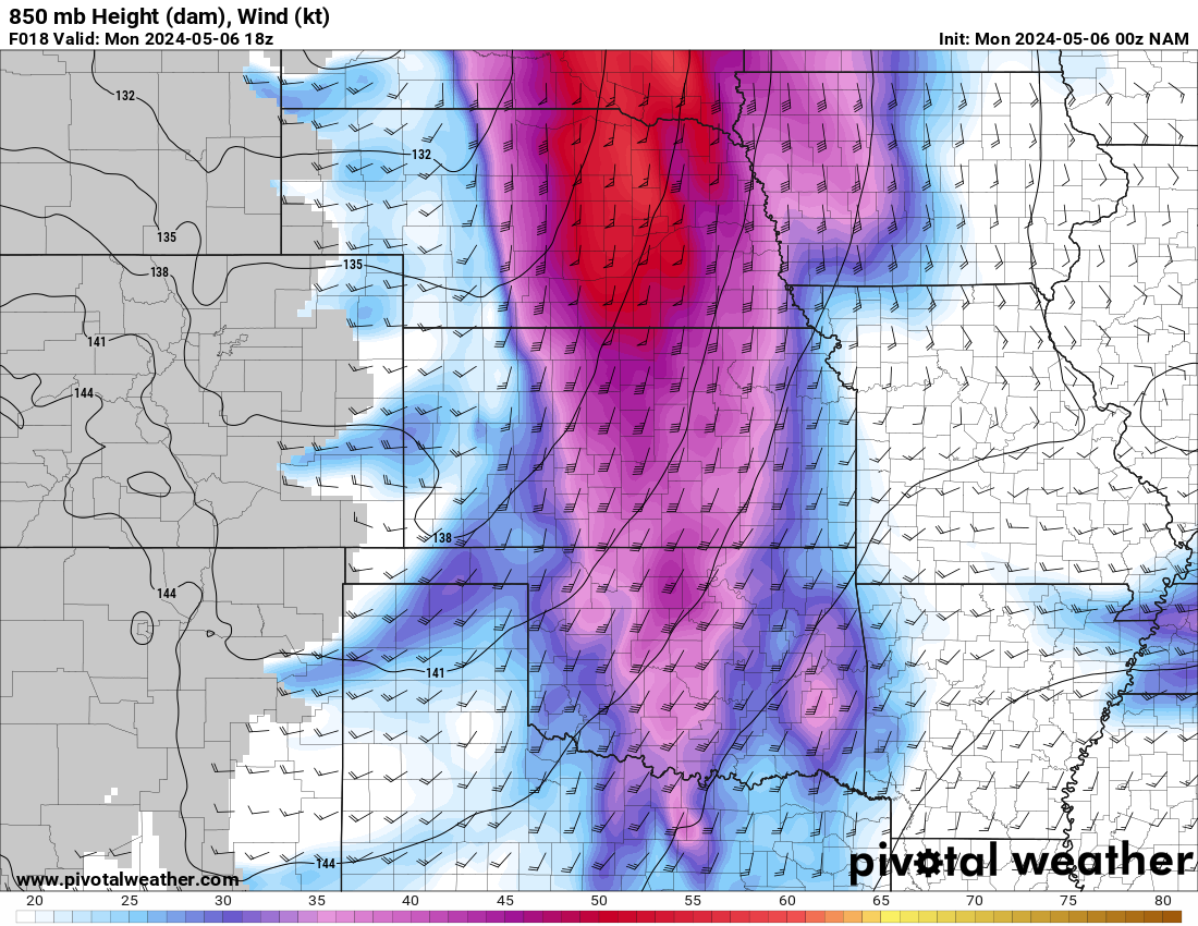
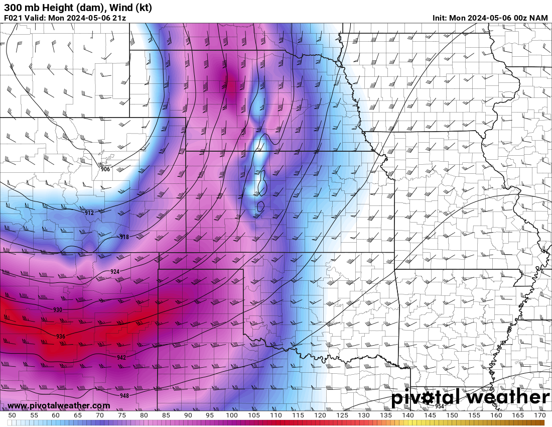
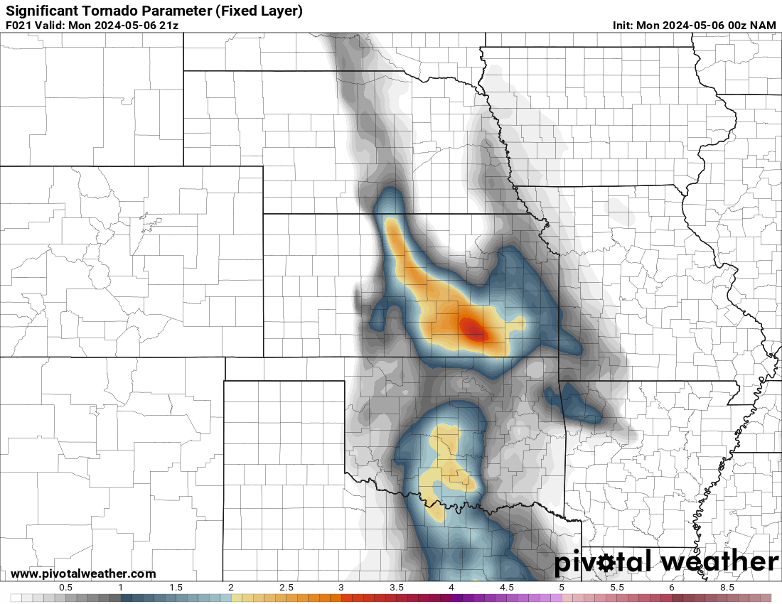
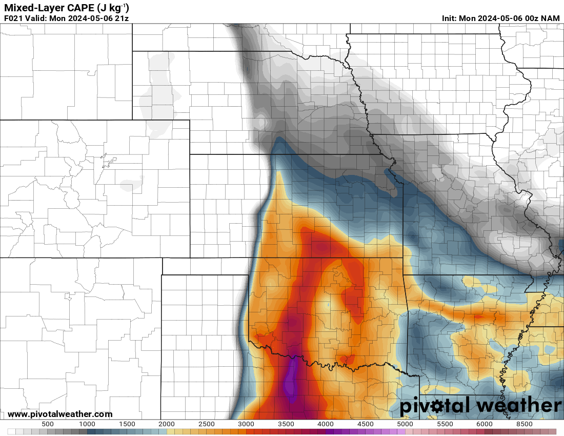
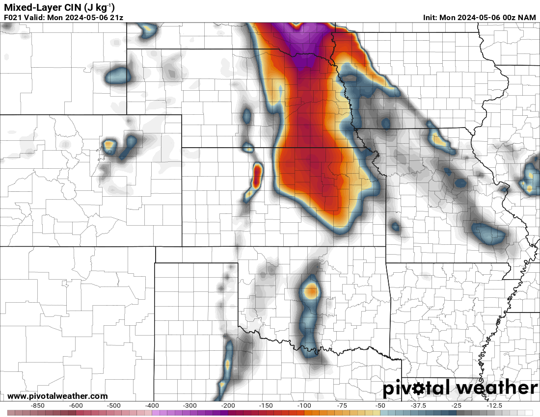
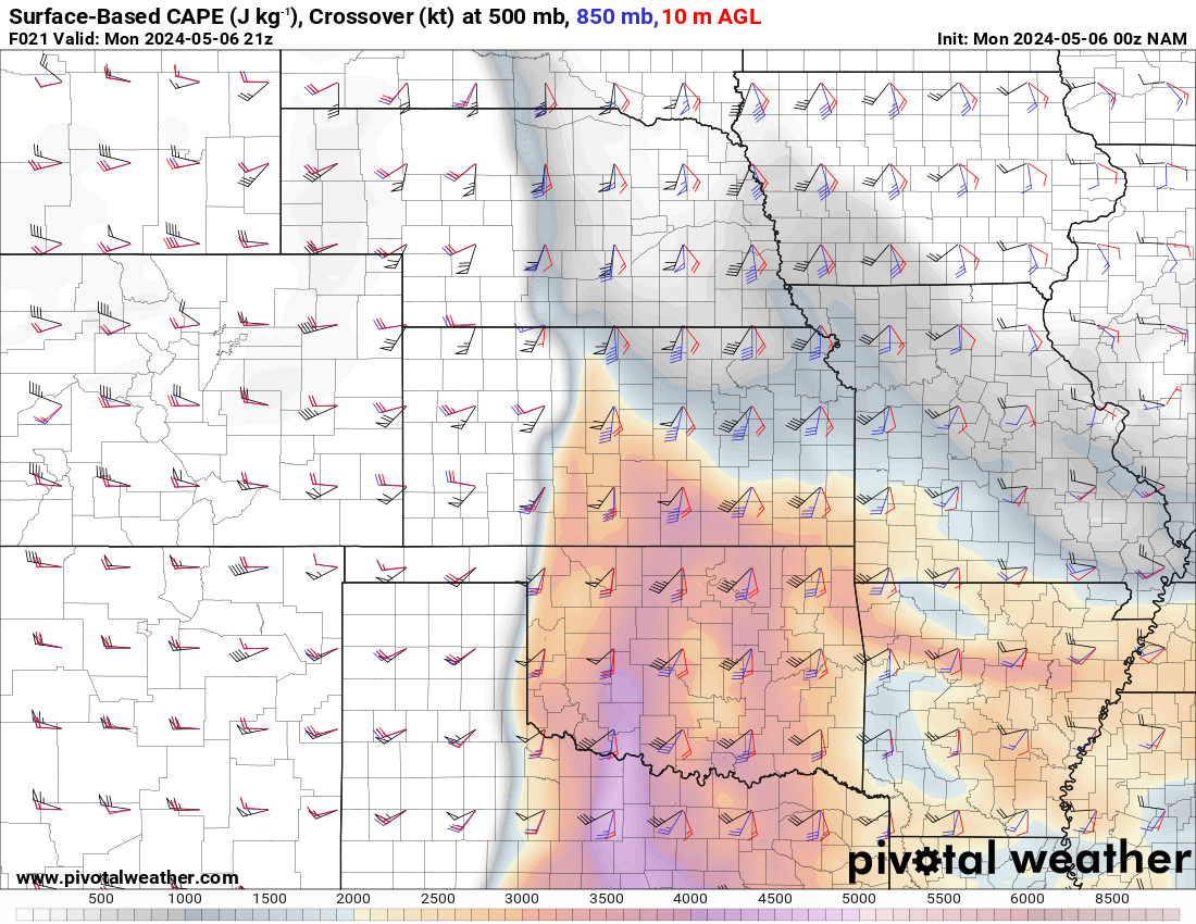
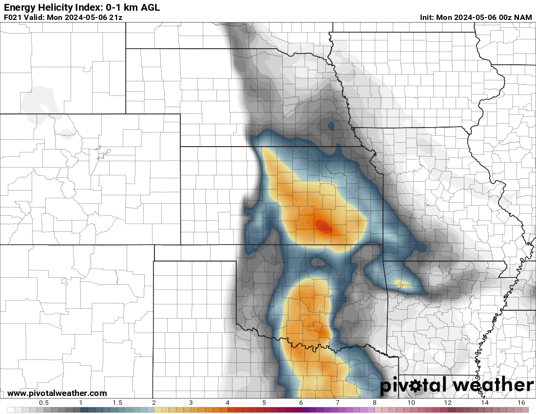
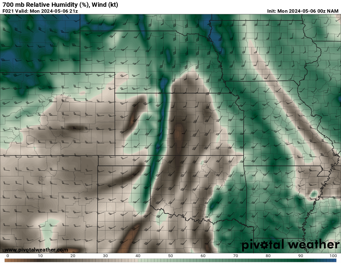
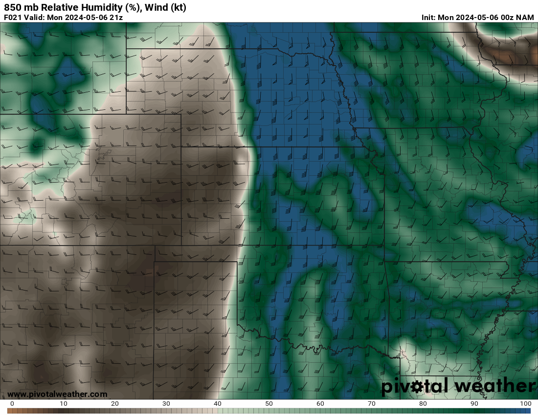
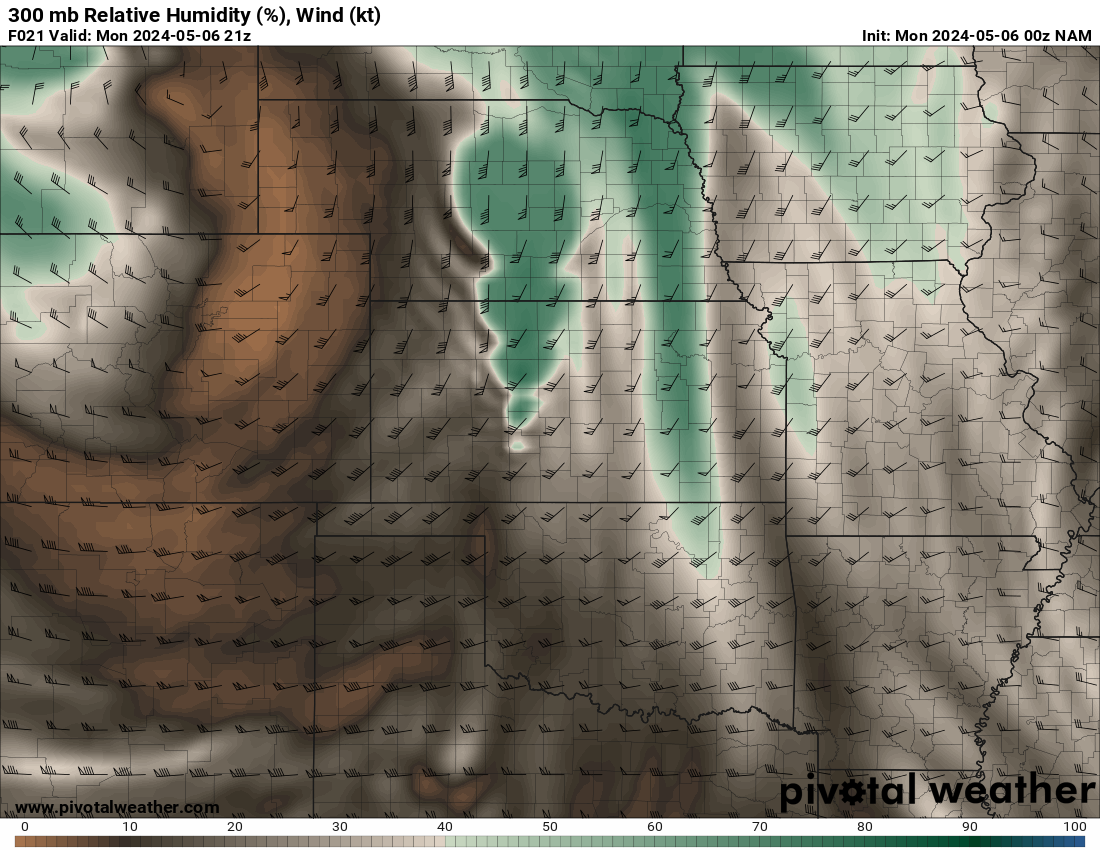
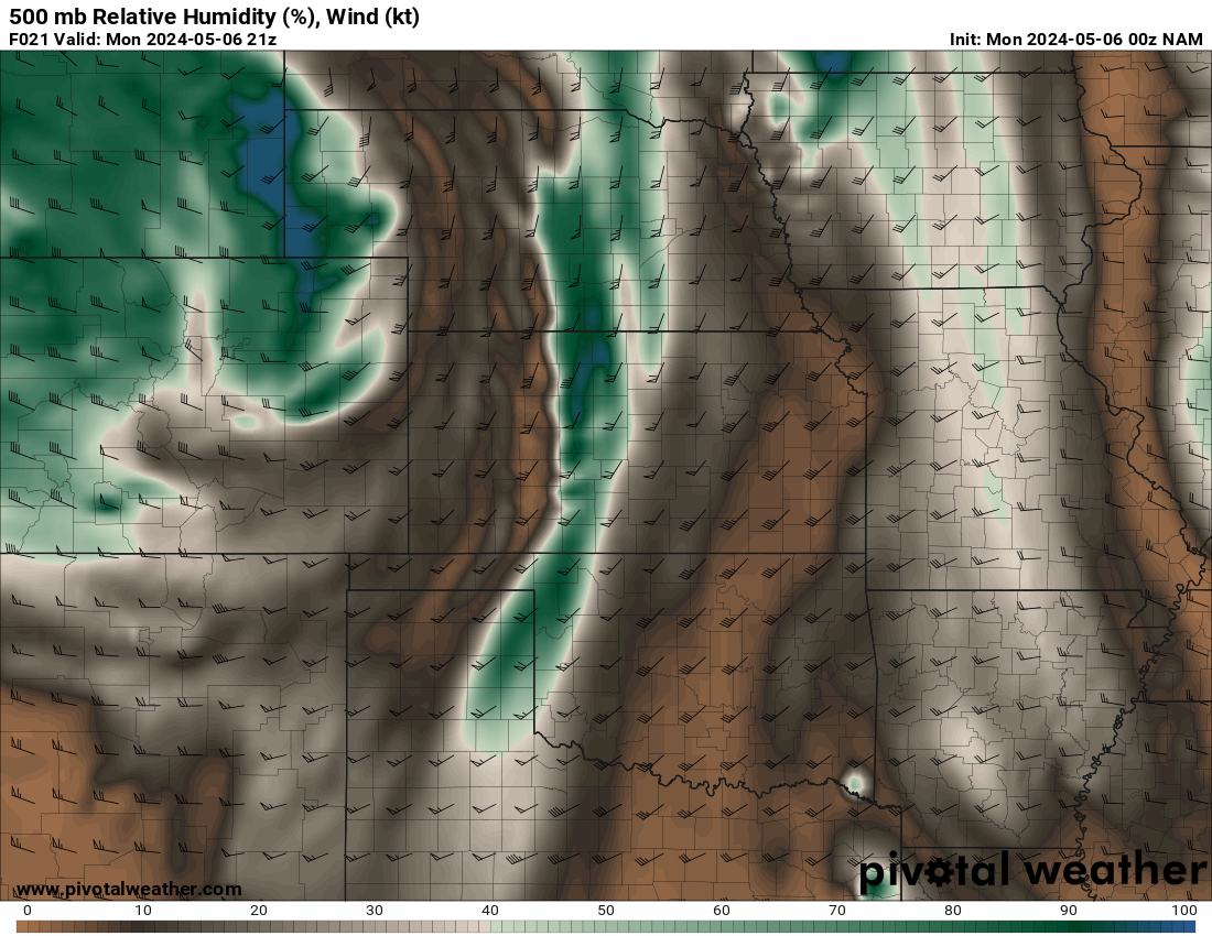
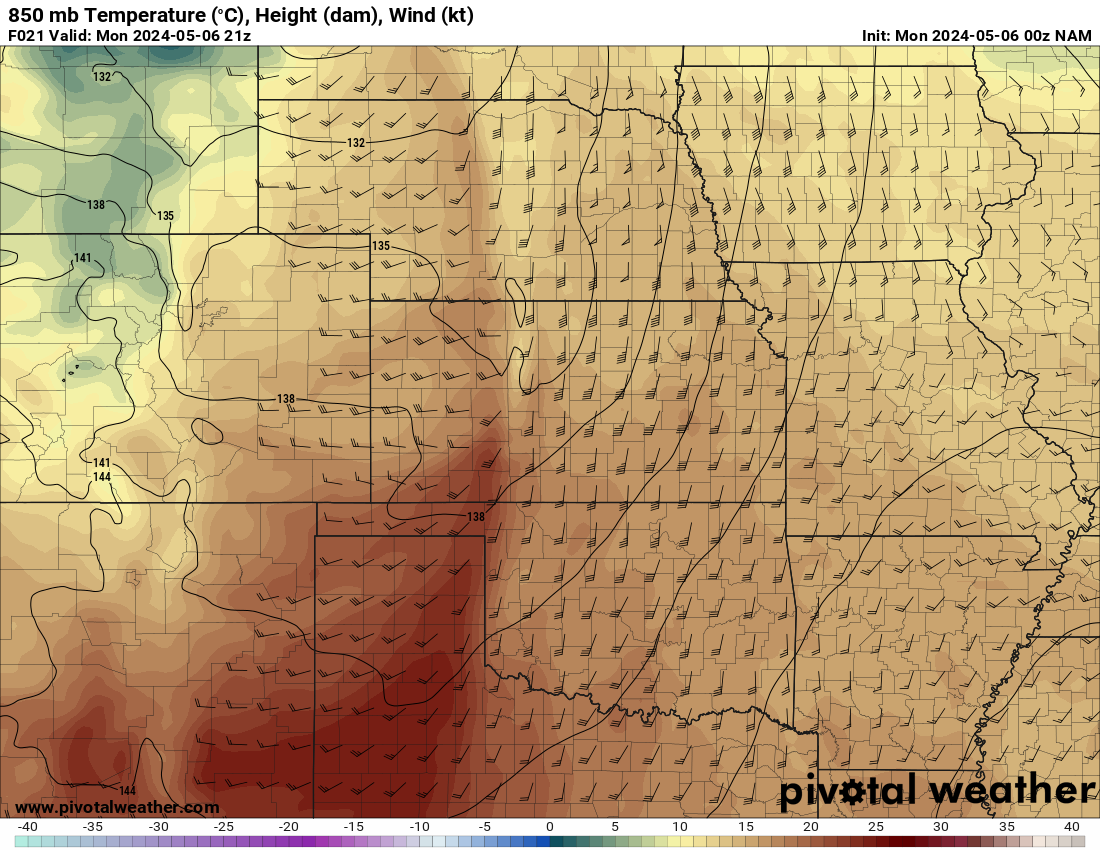
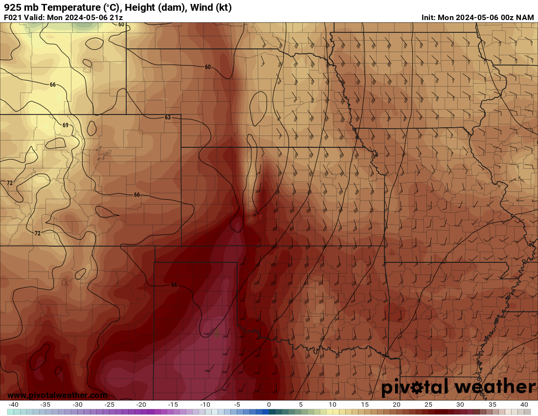
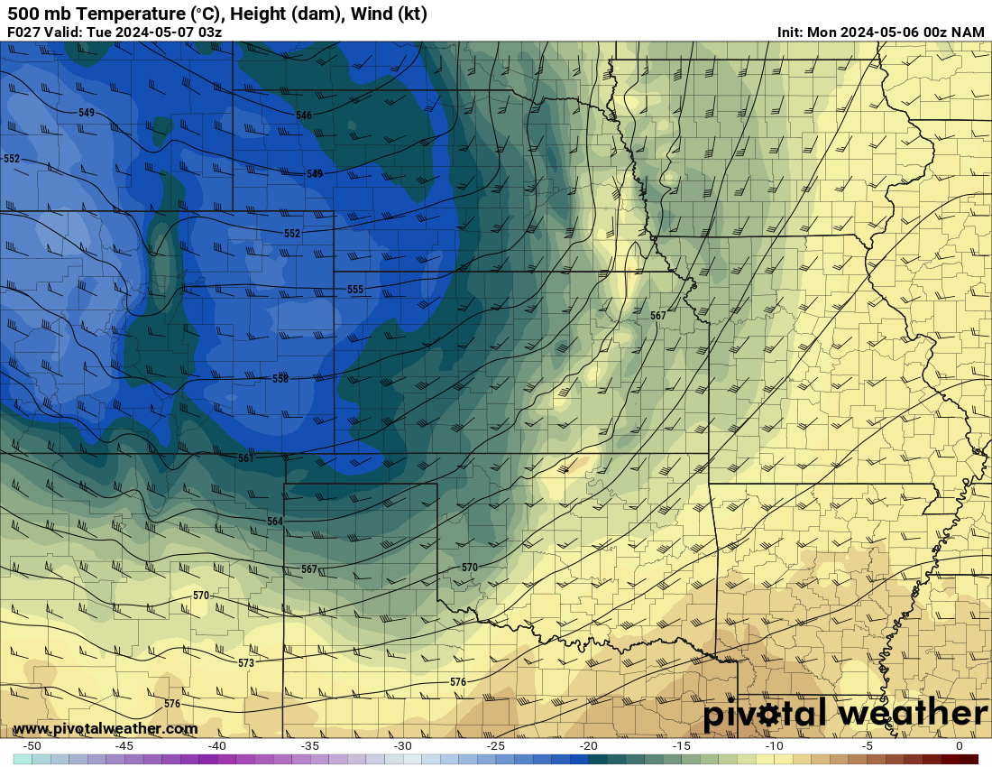
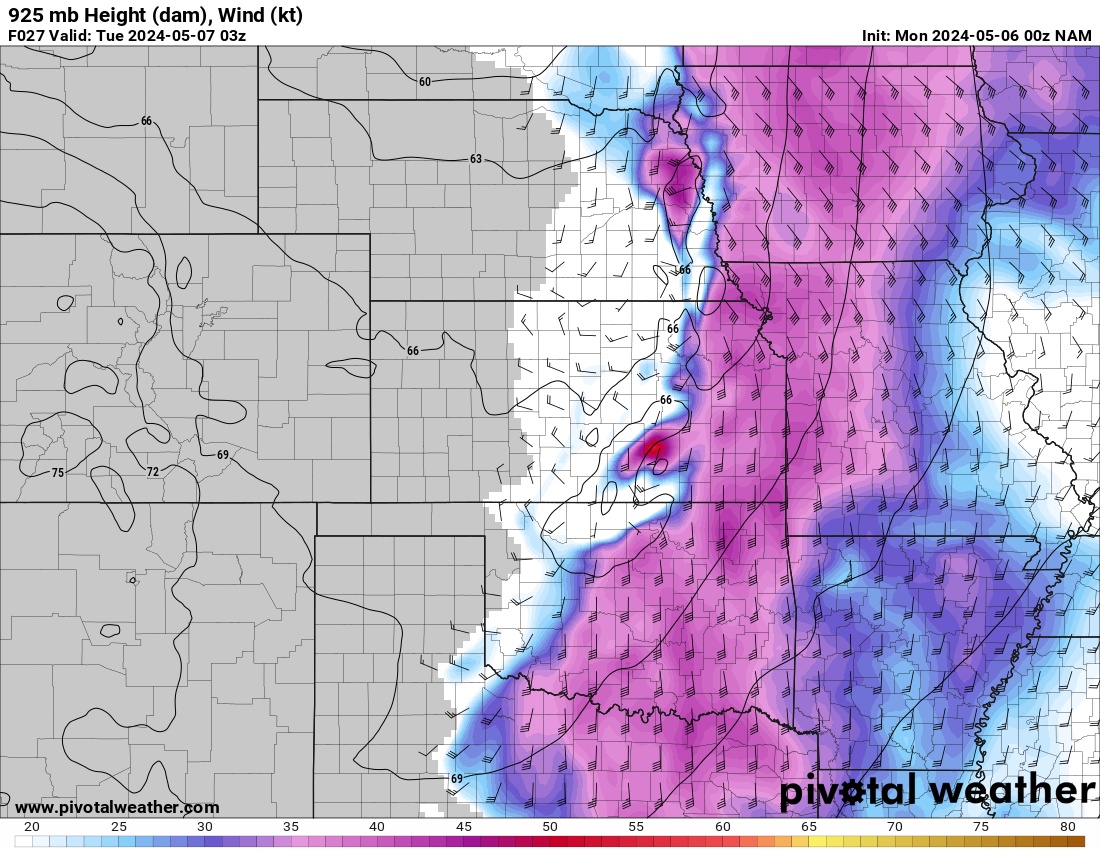
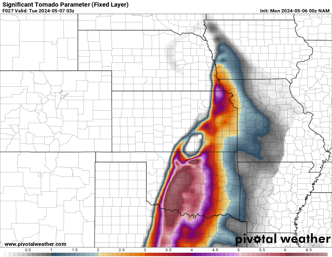
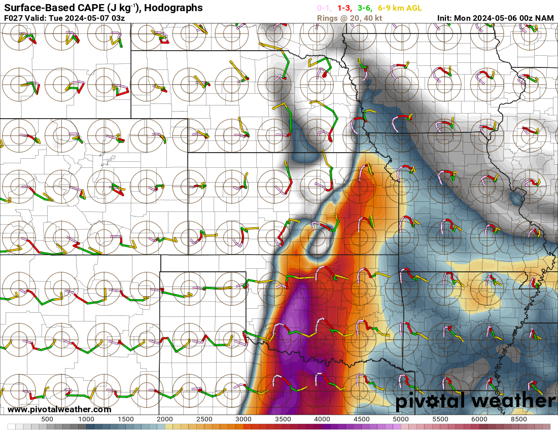
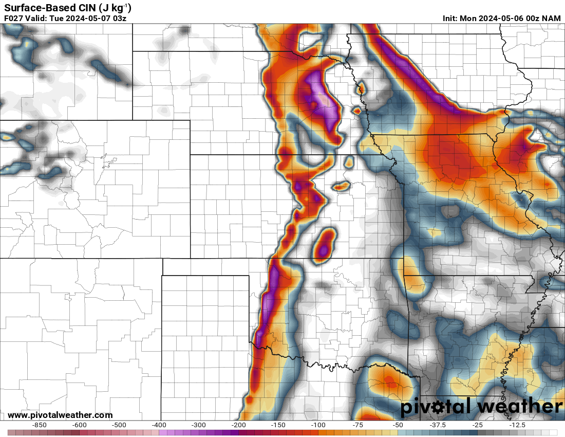
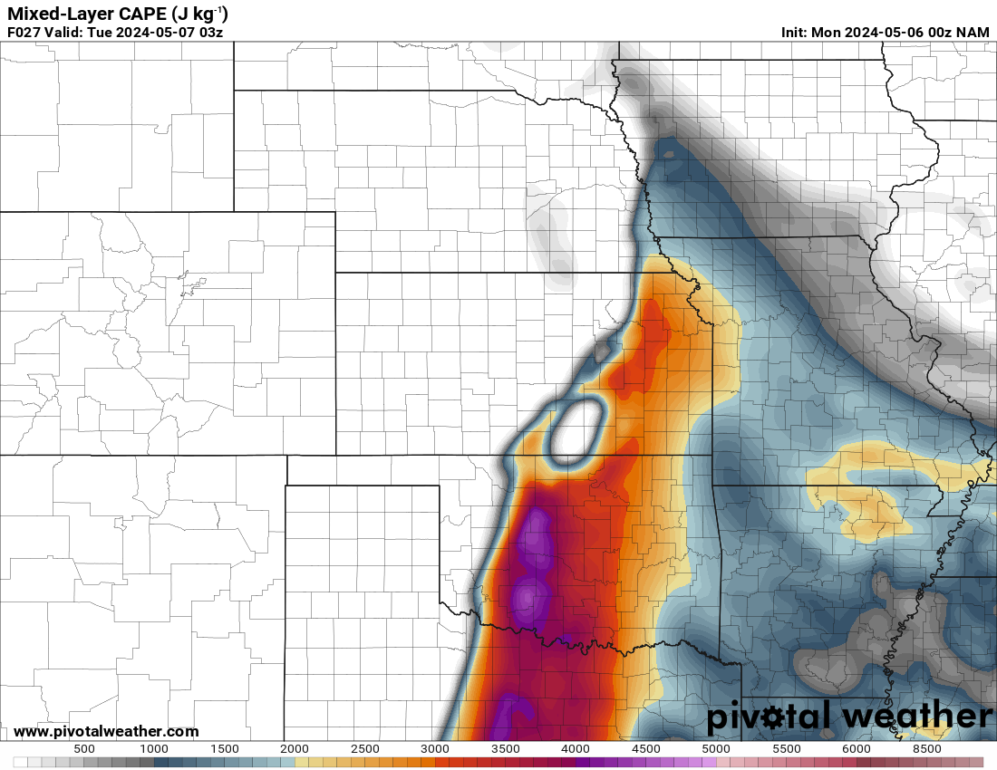
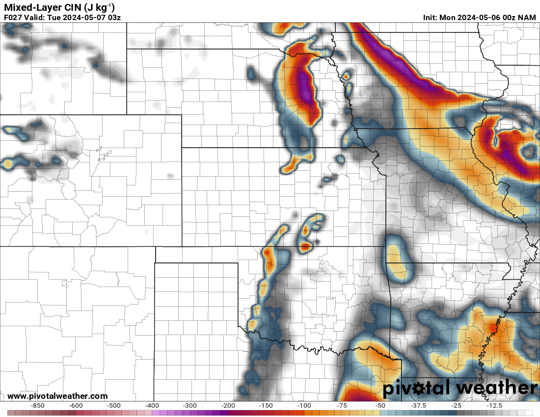
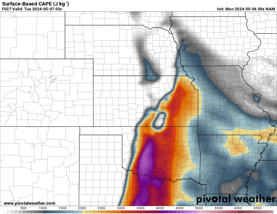
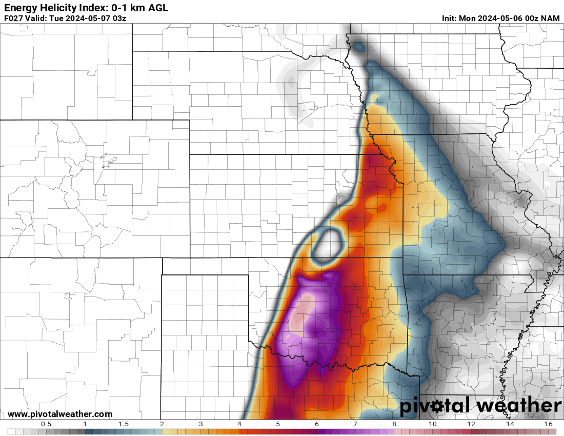
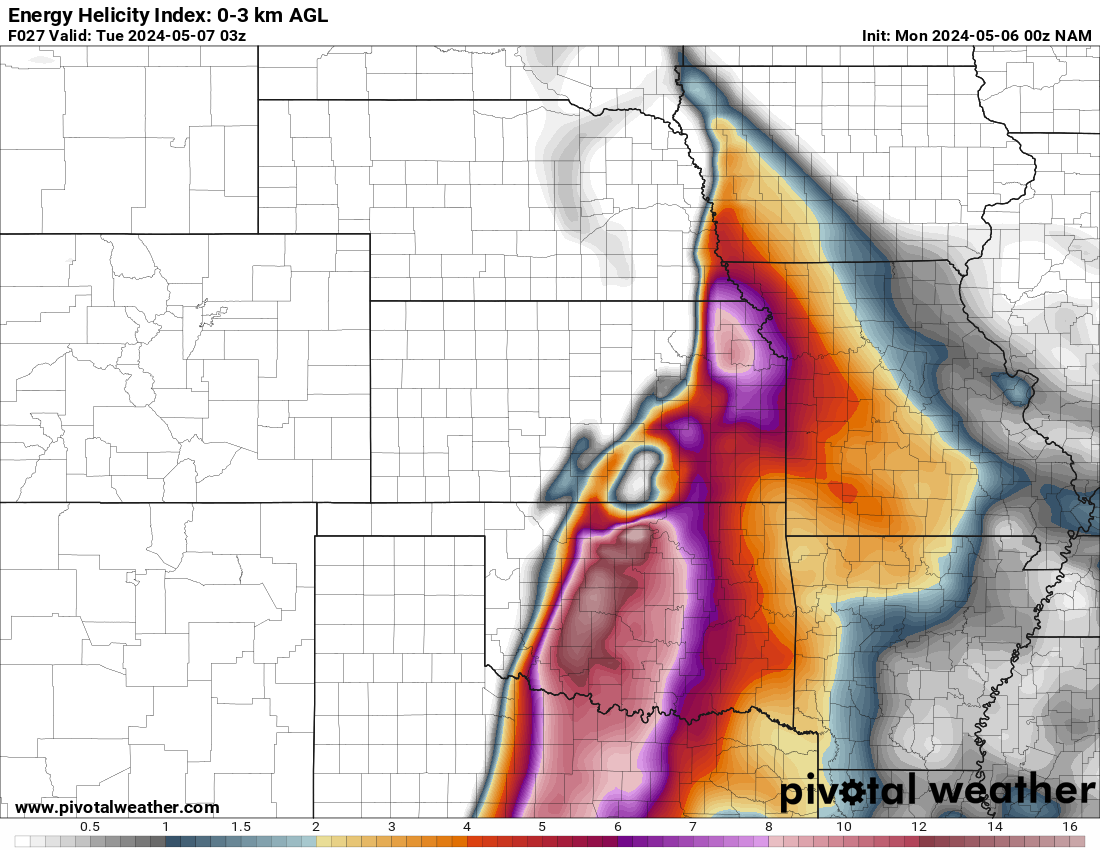
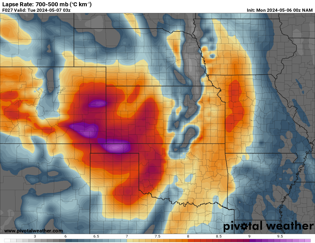
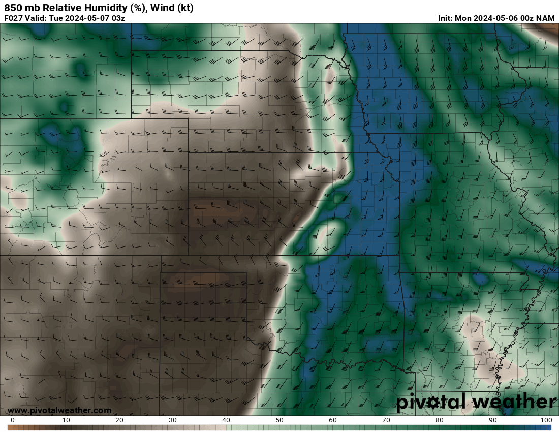
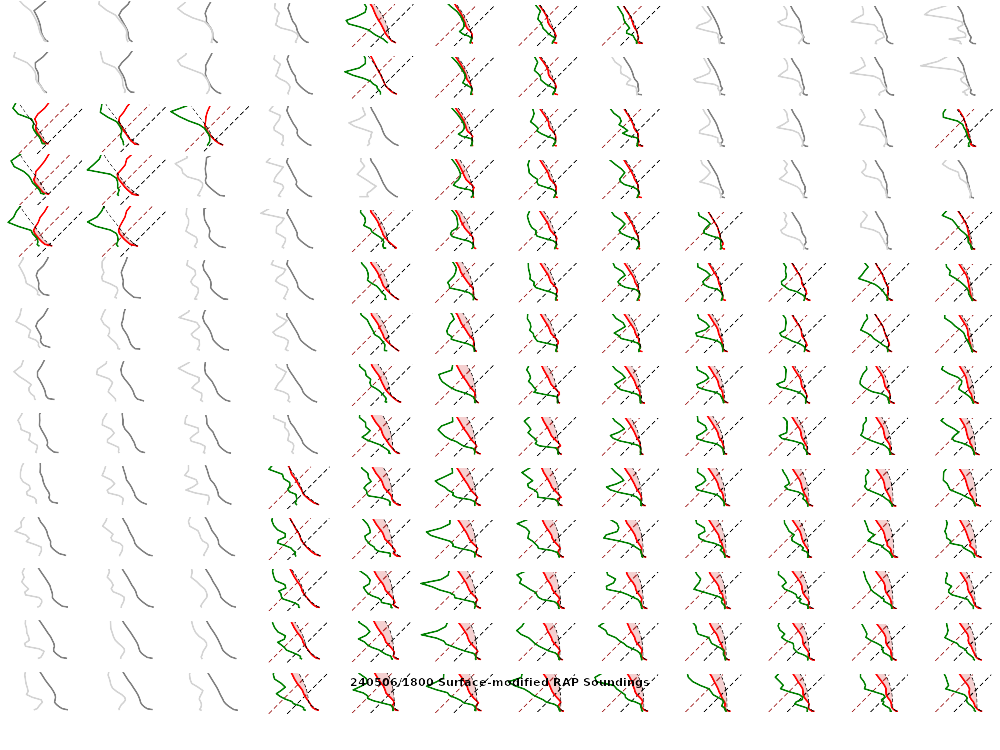
This was a well forecast event, with local news stations calling for a huge outbreak a couple of days out. The model soundings were pretty impressive as a strong trough moved over the rockies and into the great plains.
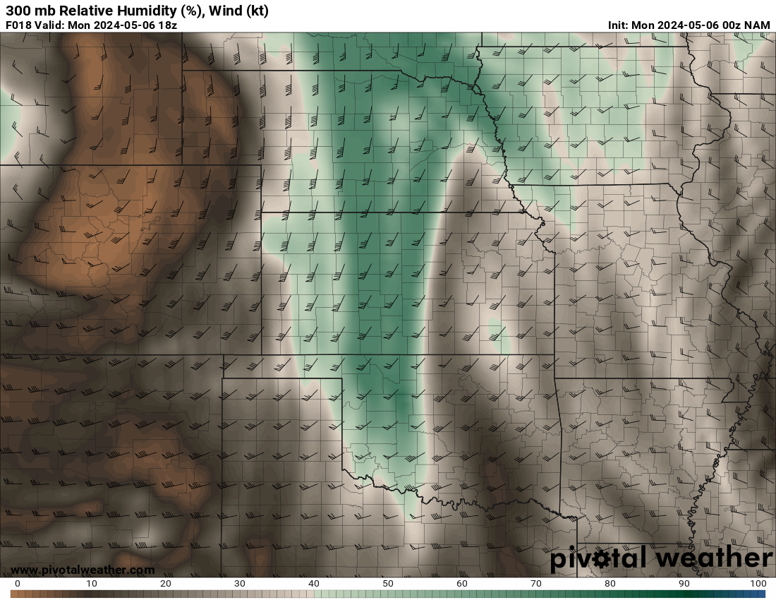
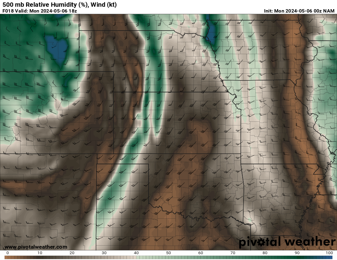
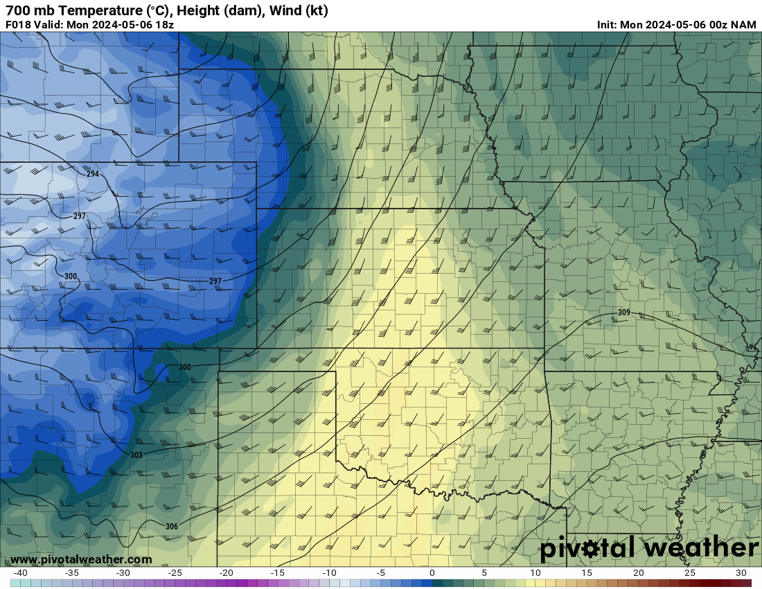
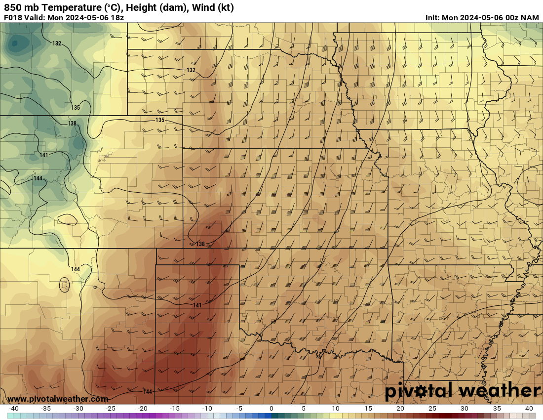
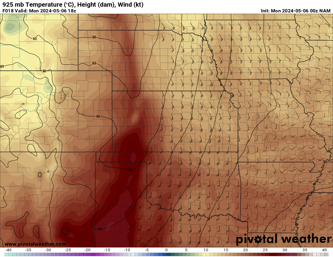
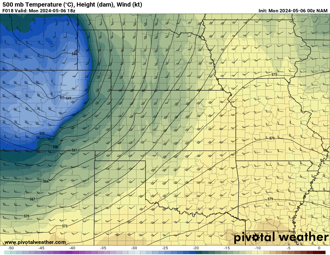
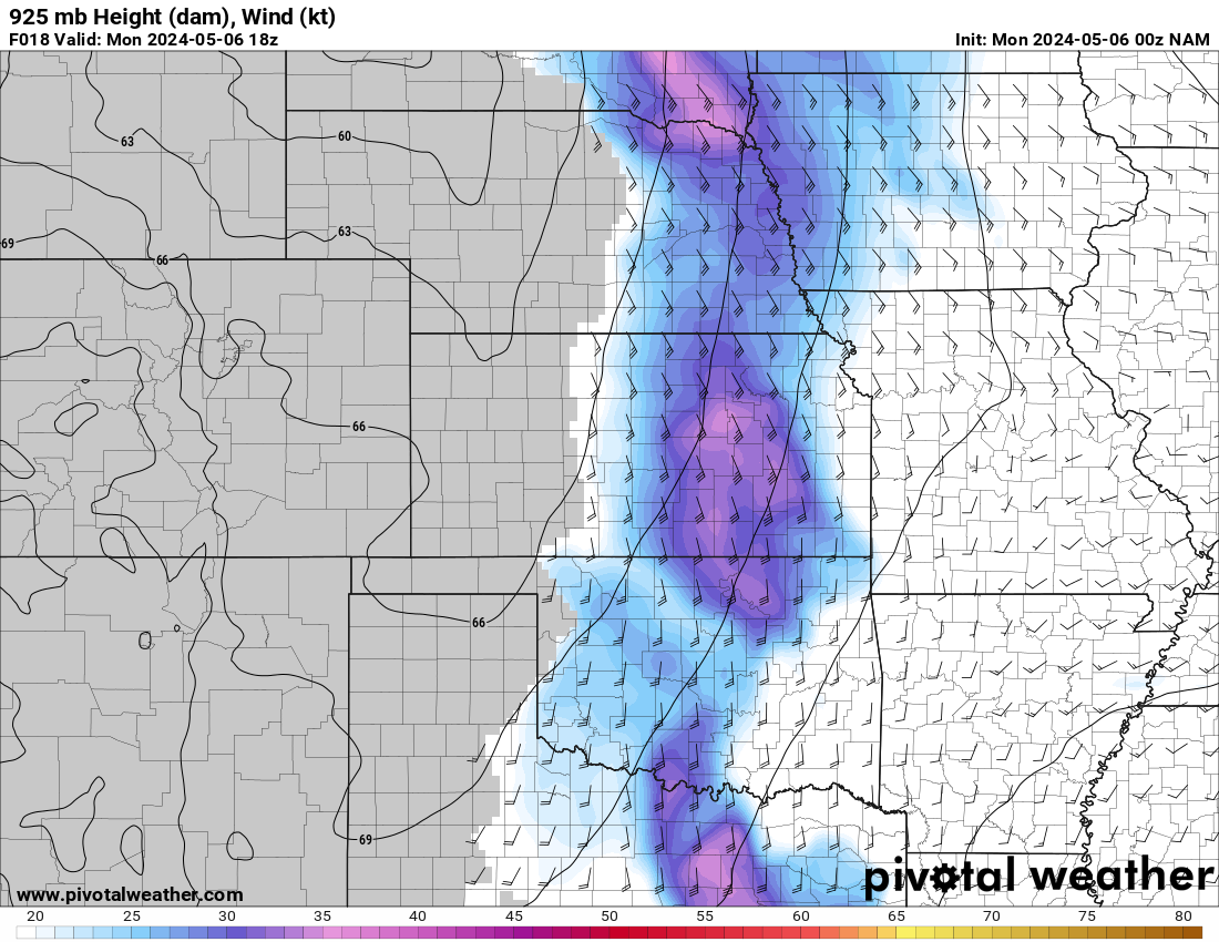
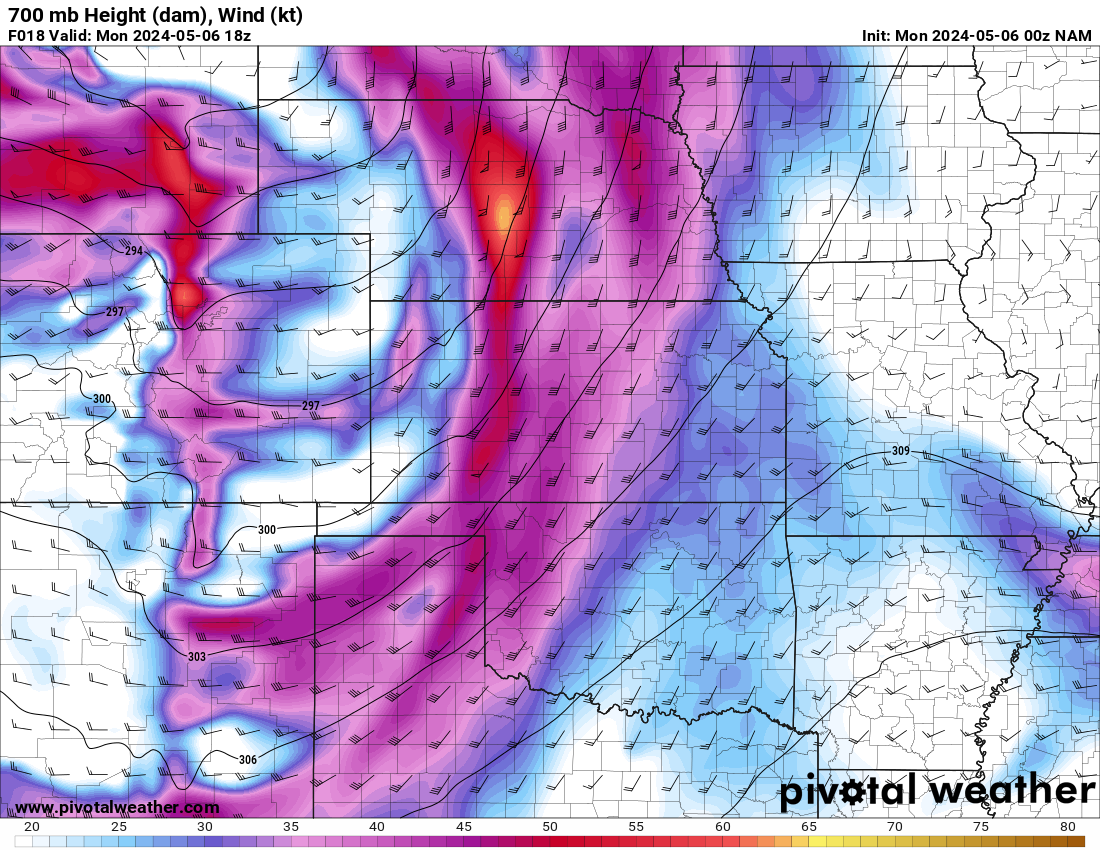
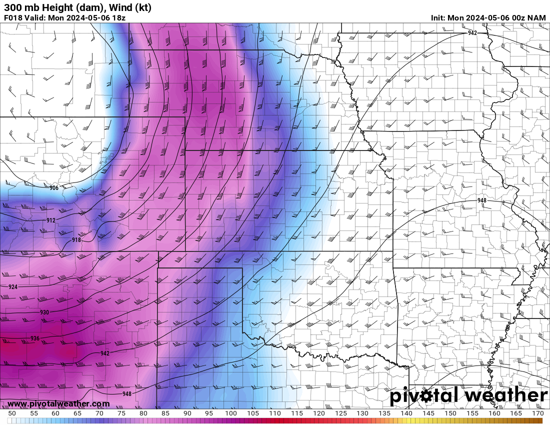
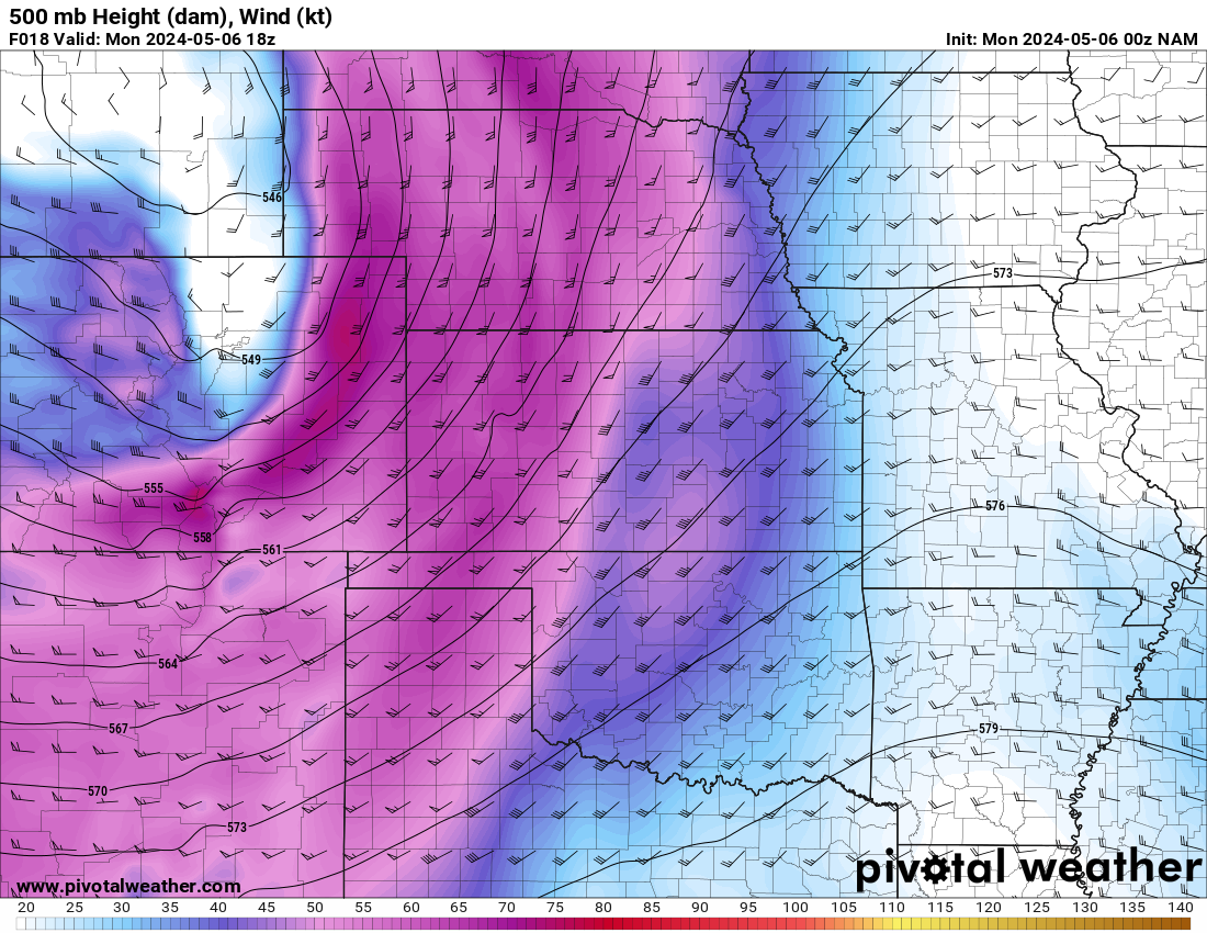
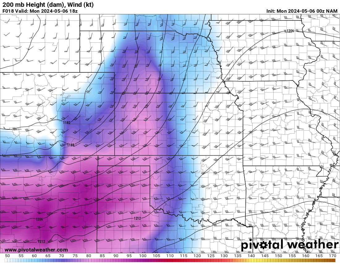
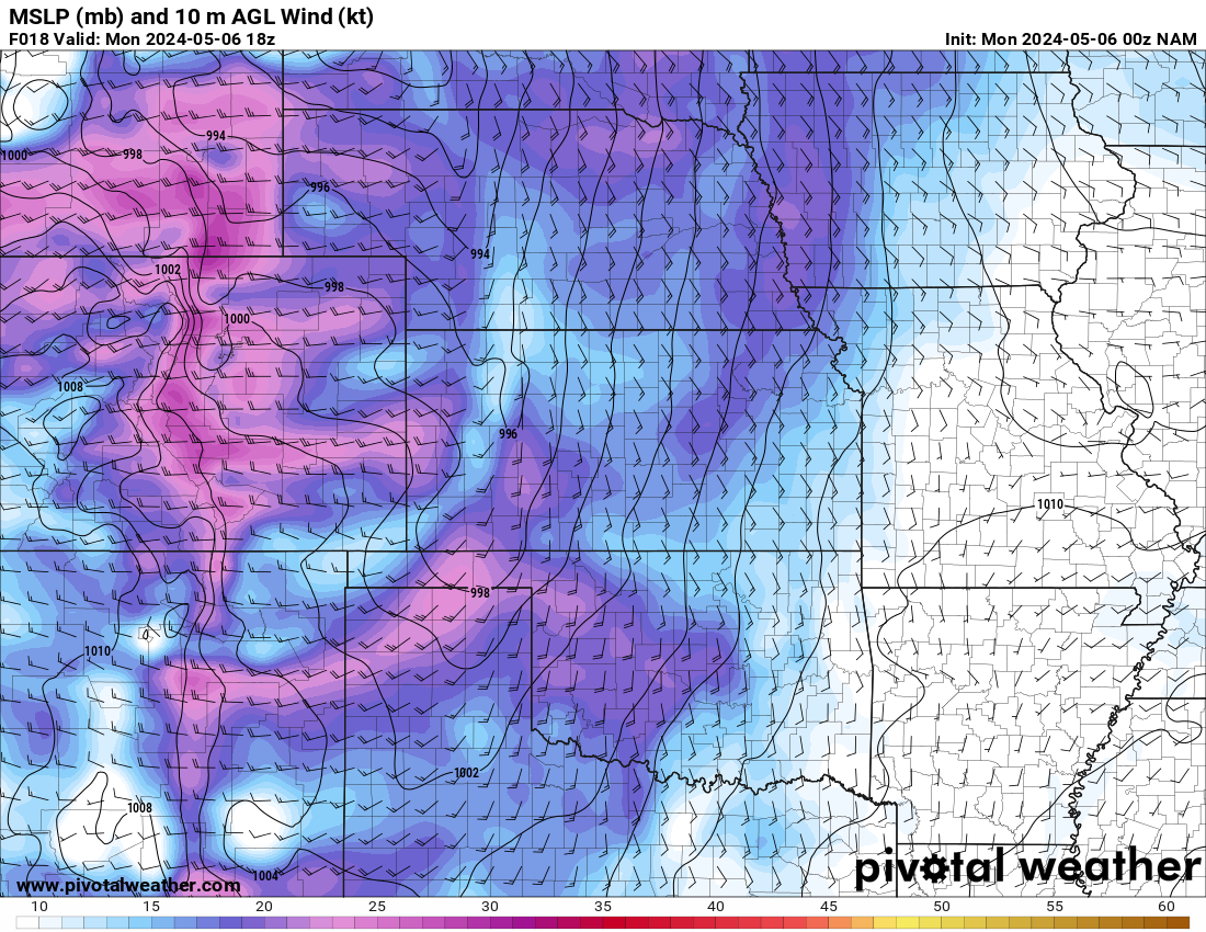
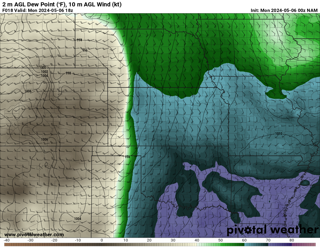
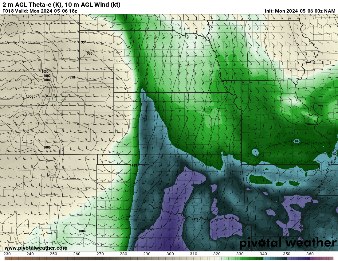
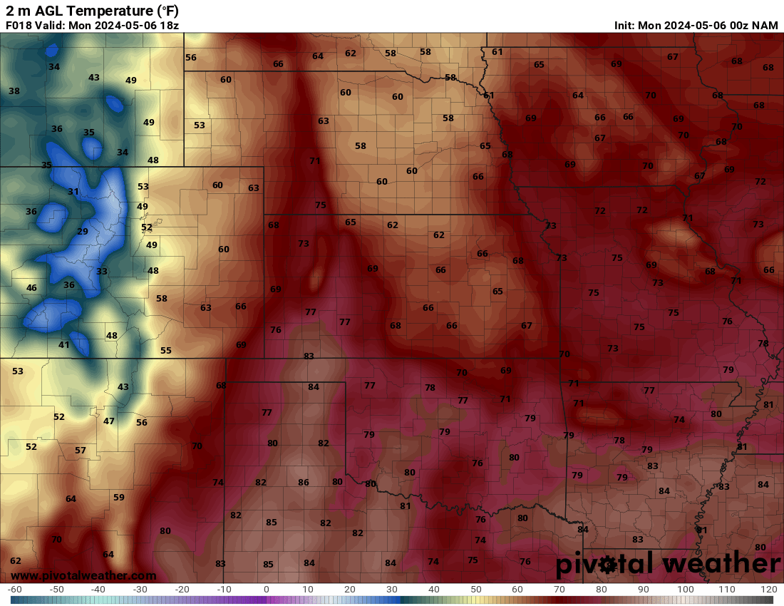
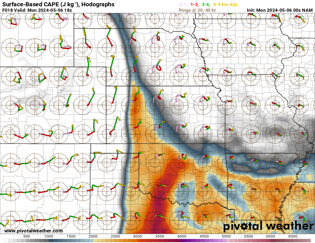
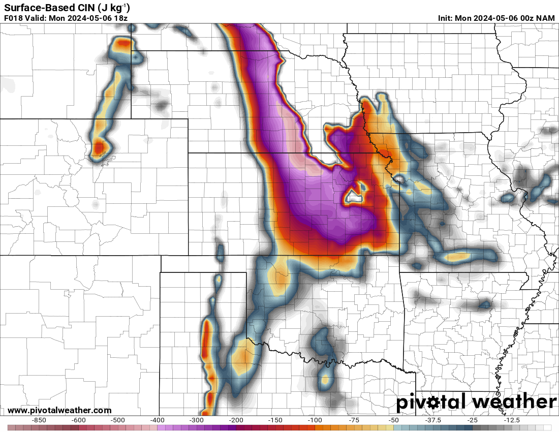
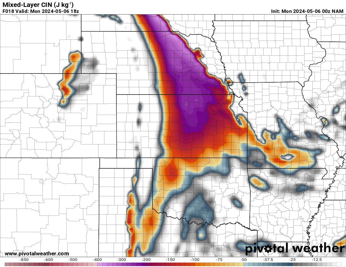
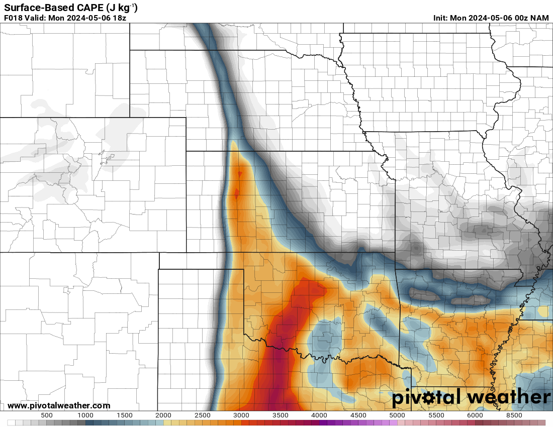
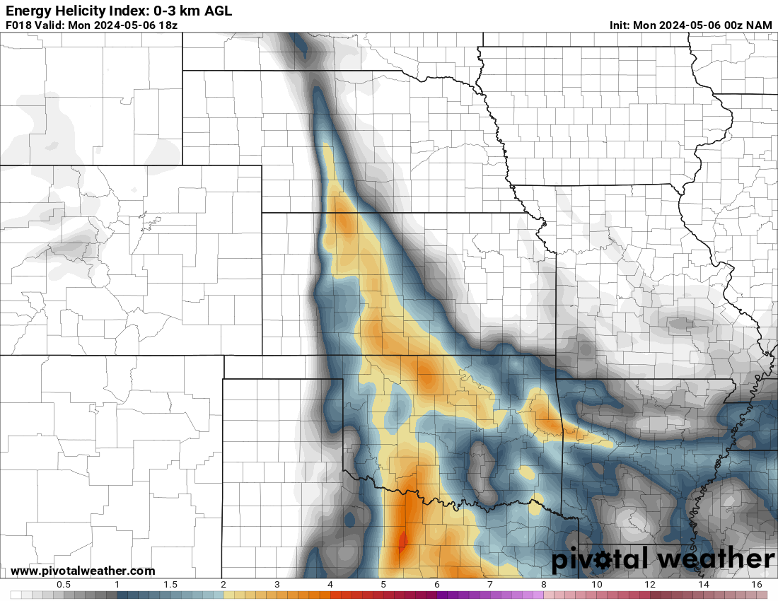
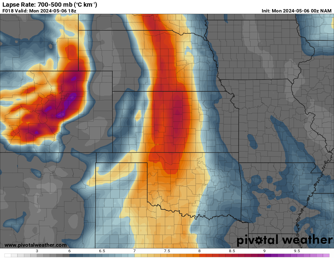
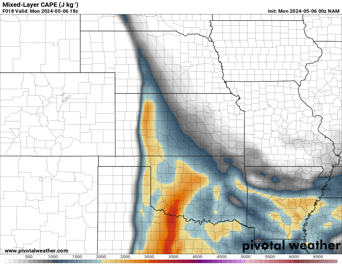
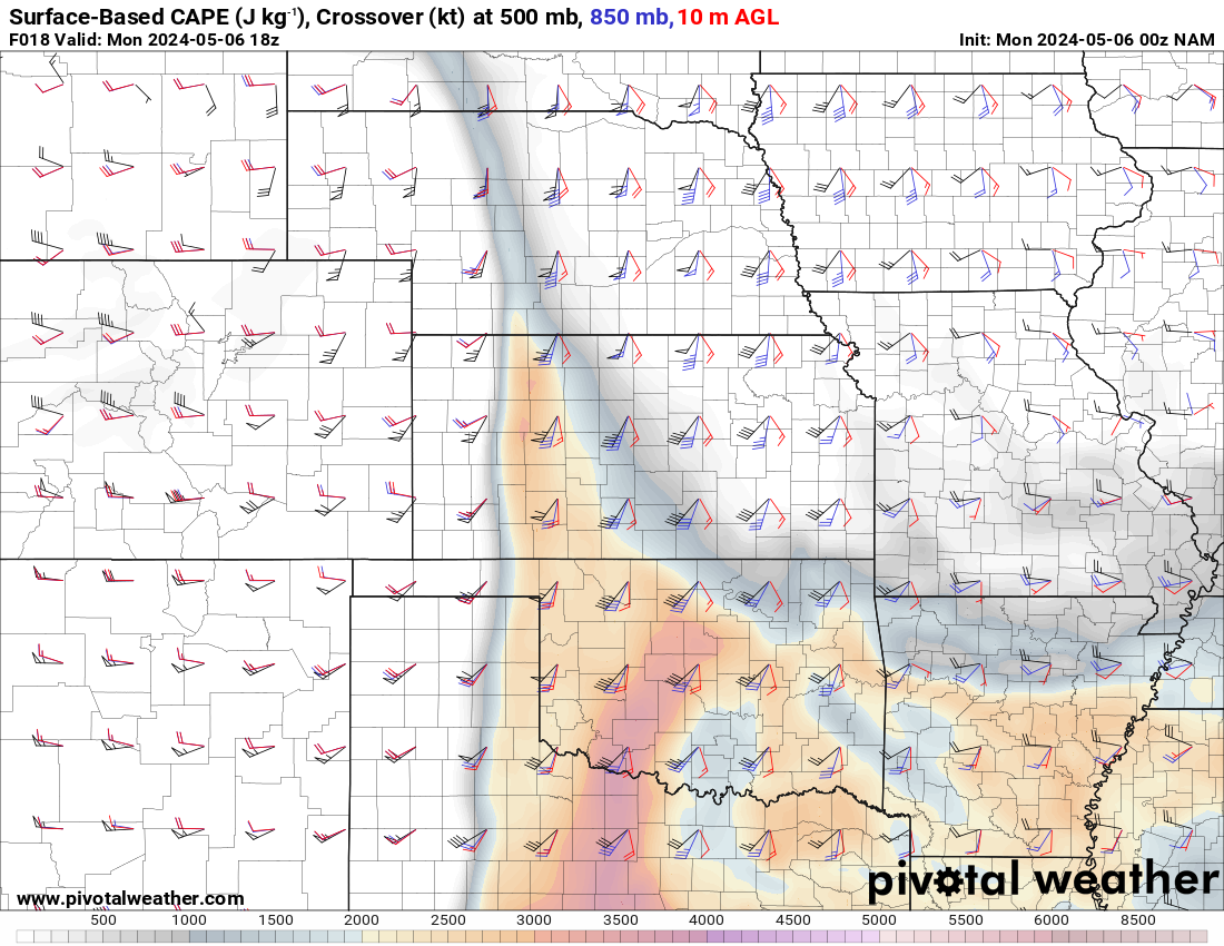
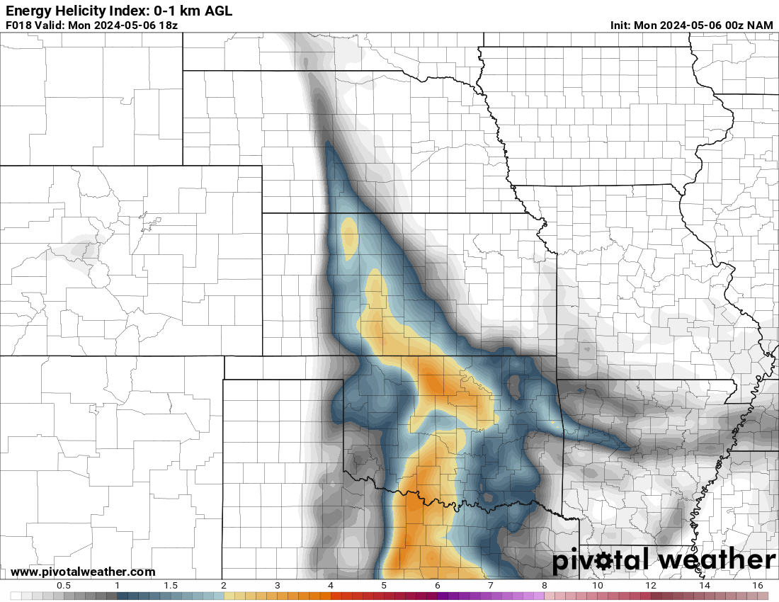
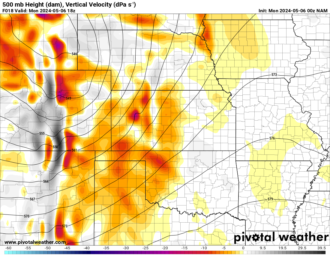
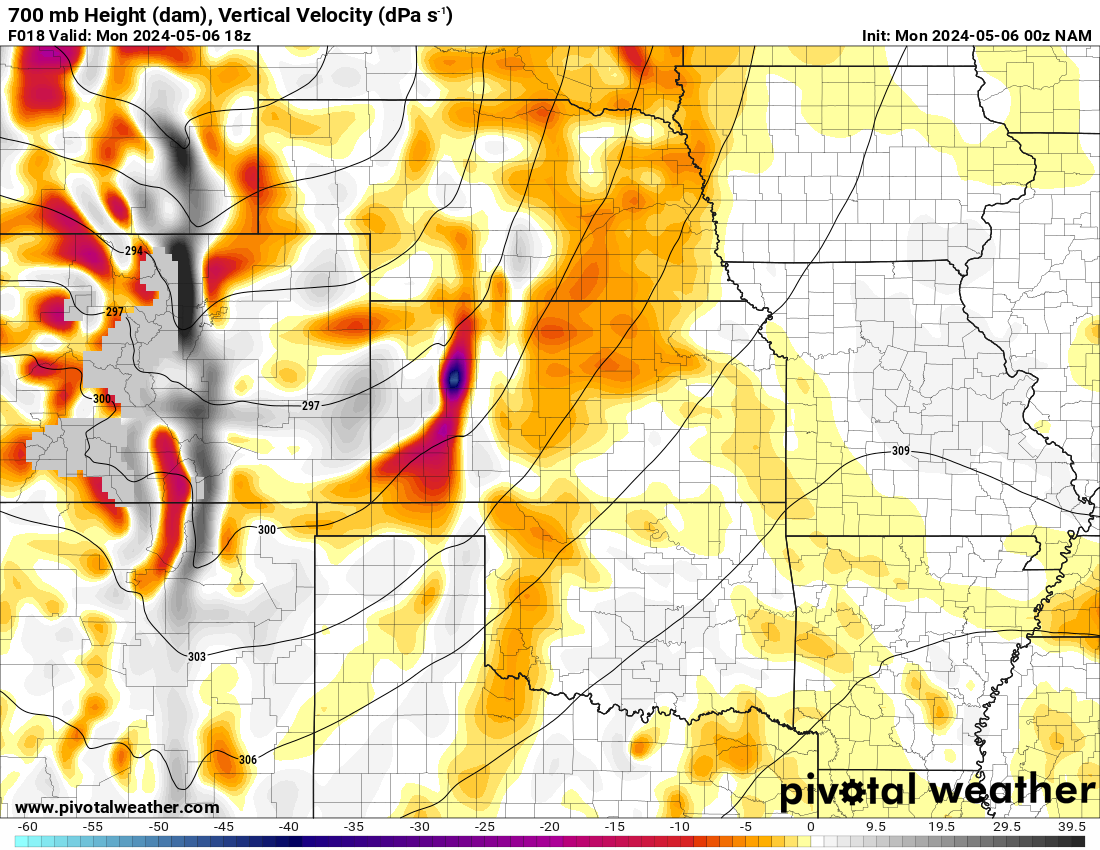
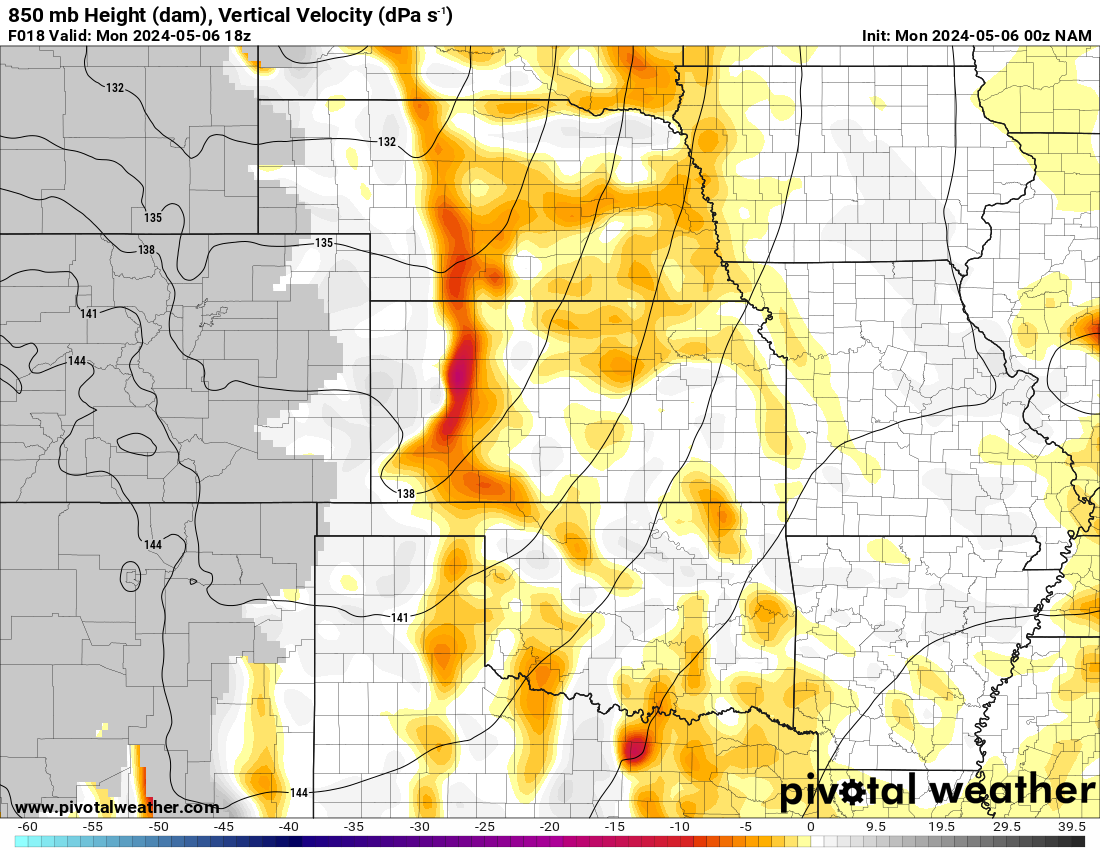
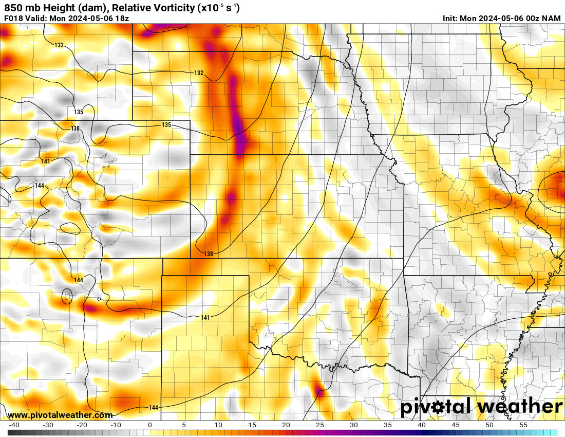
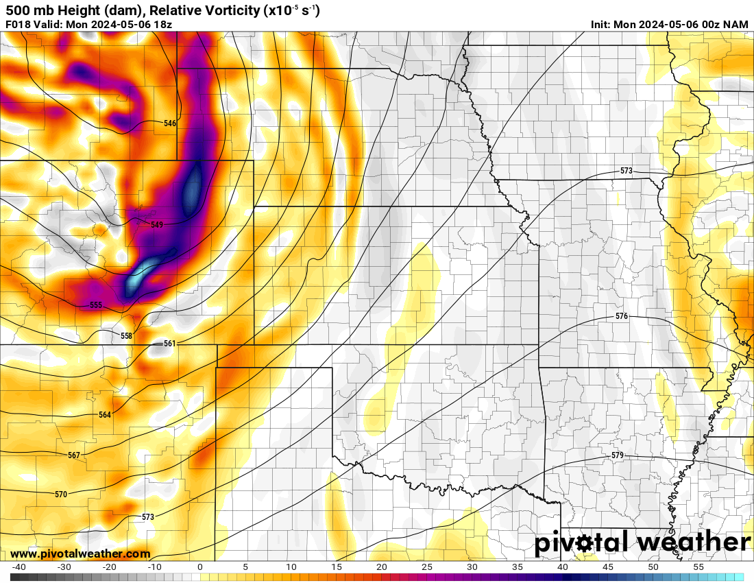
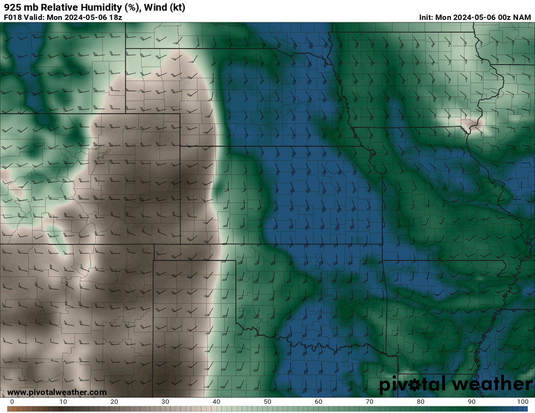
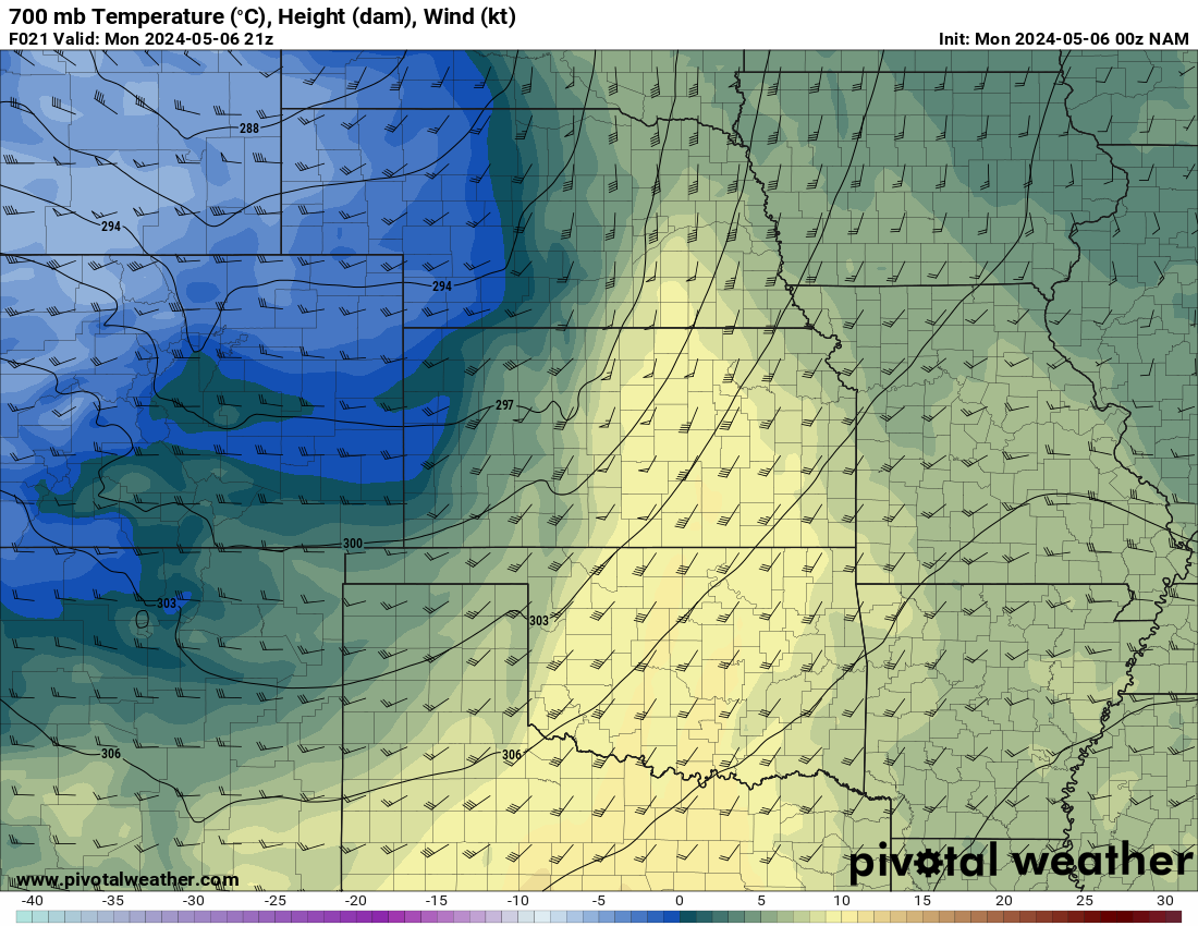
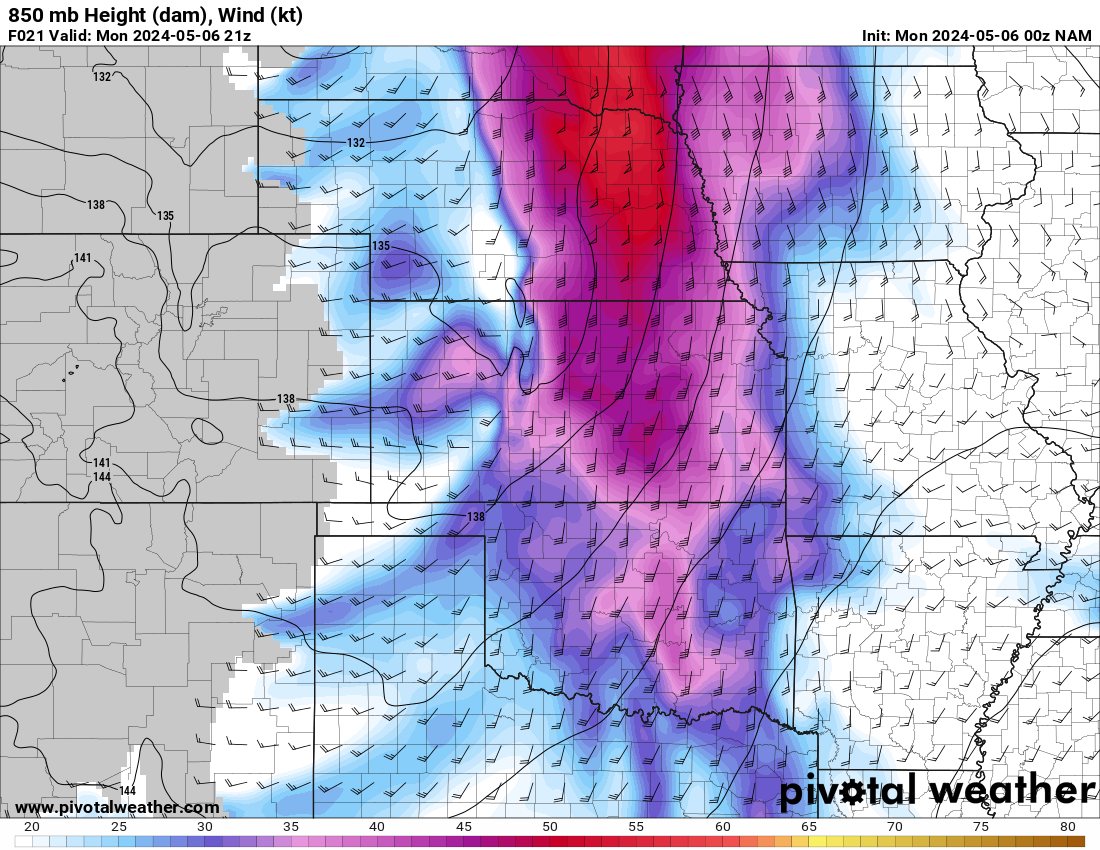
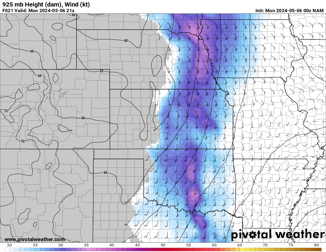
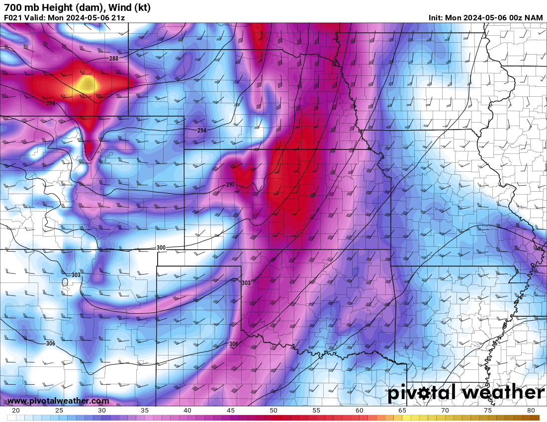
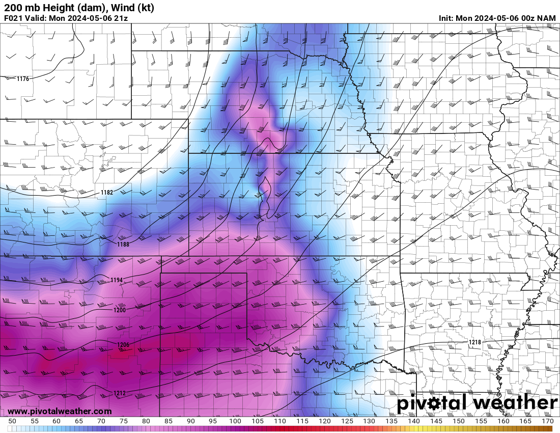
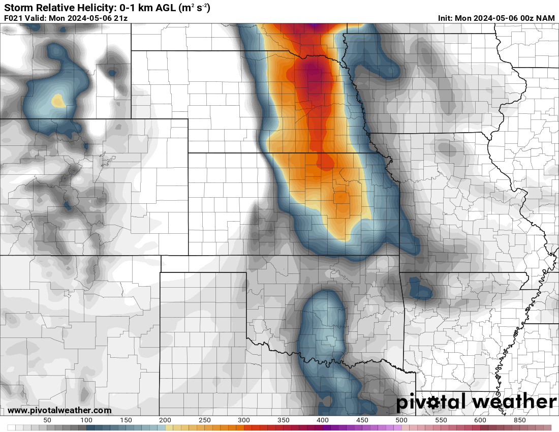
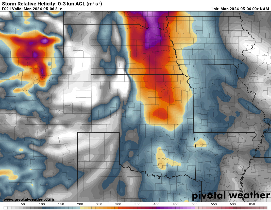
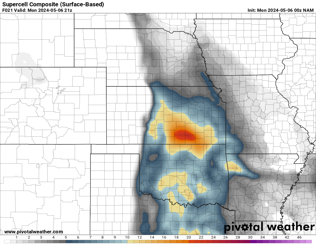
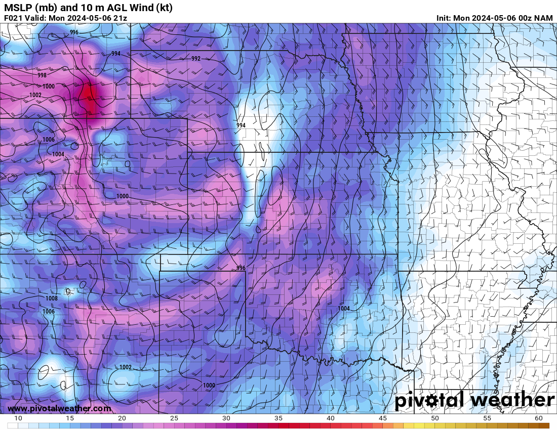
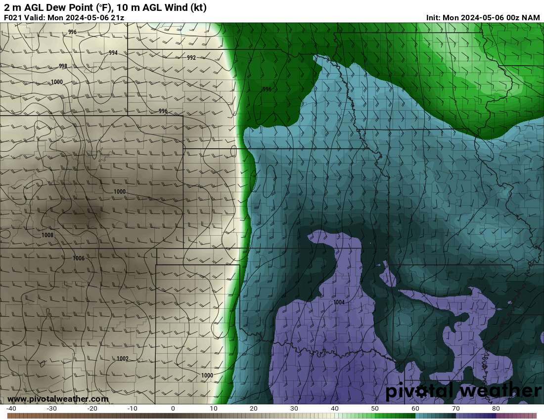
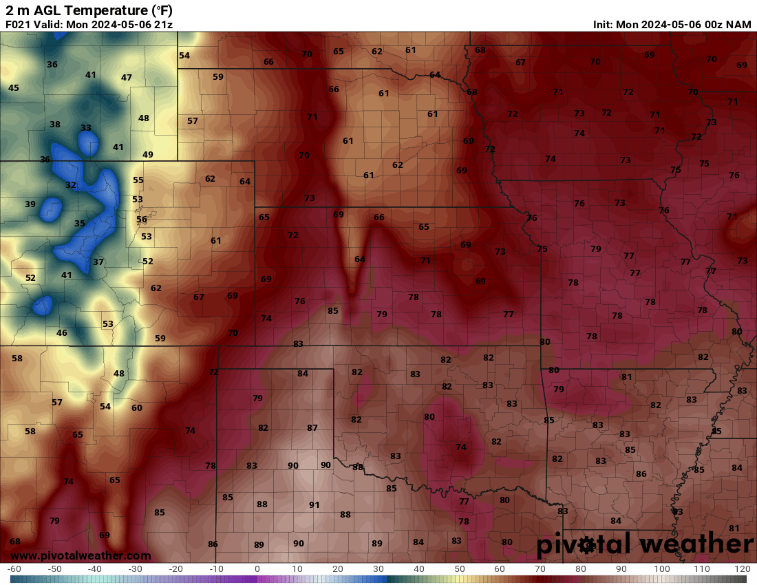
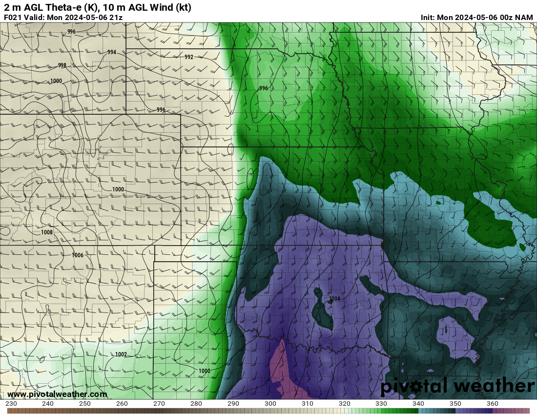
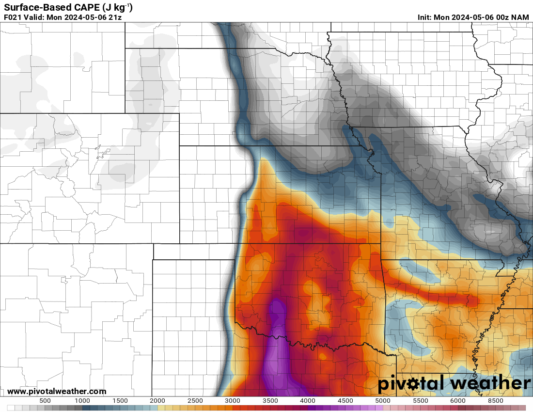
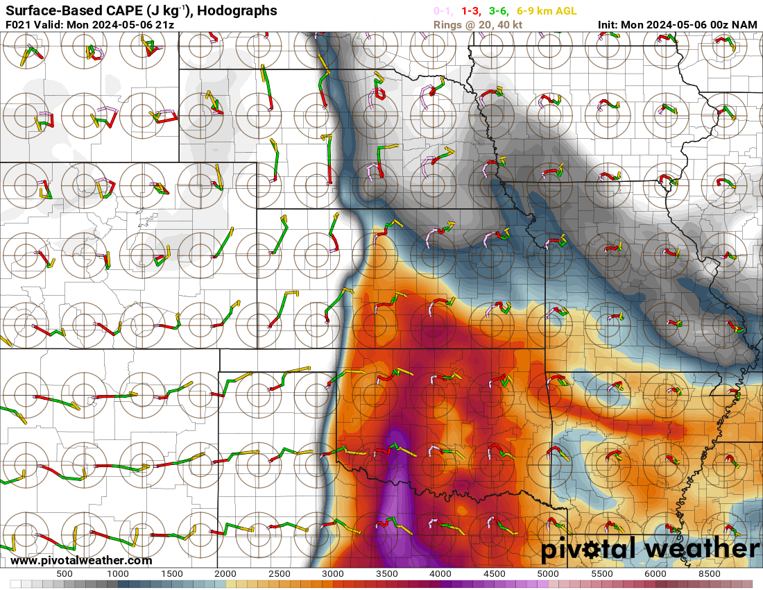
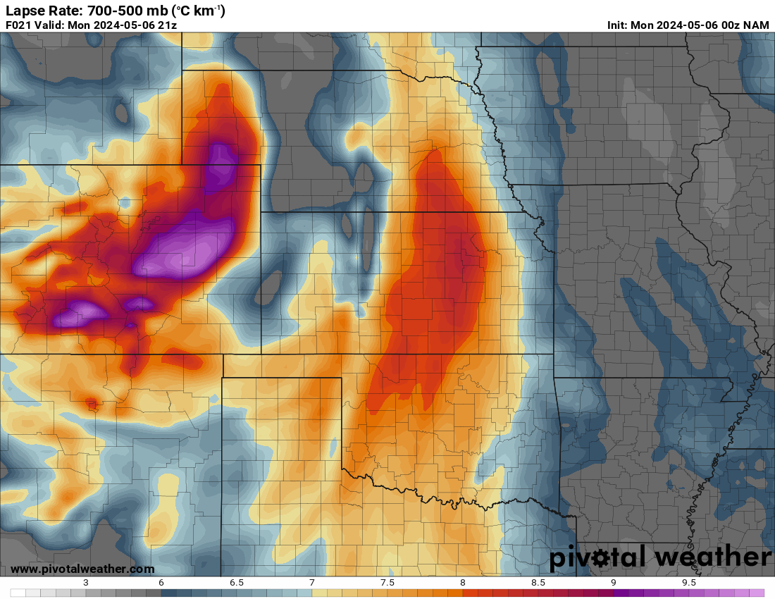
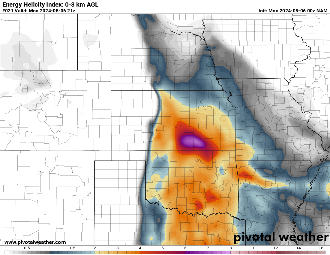
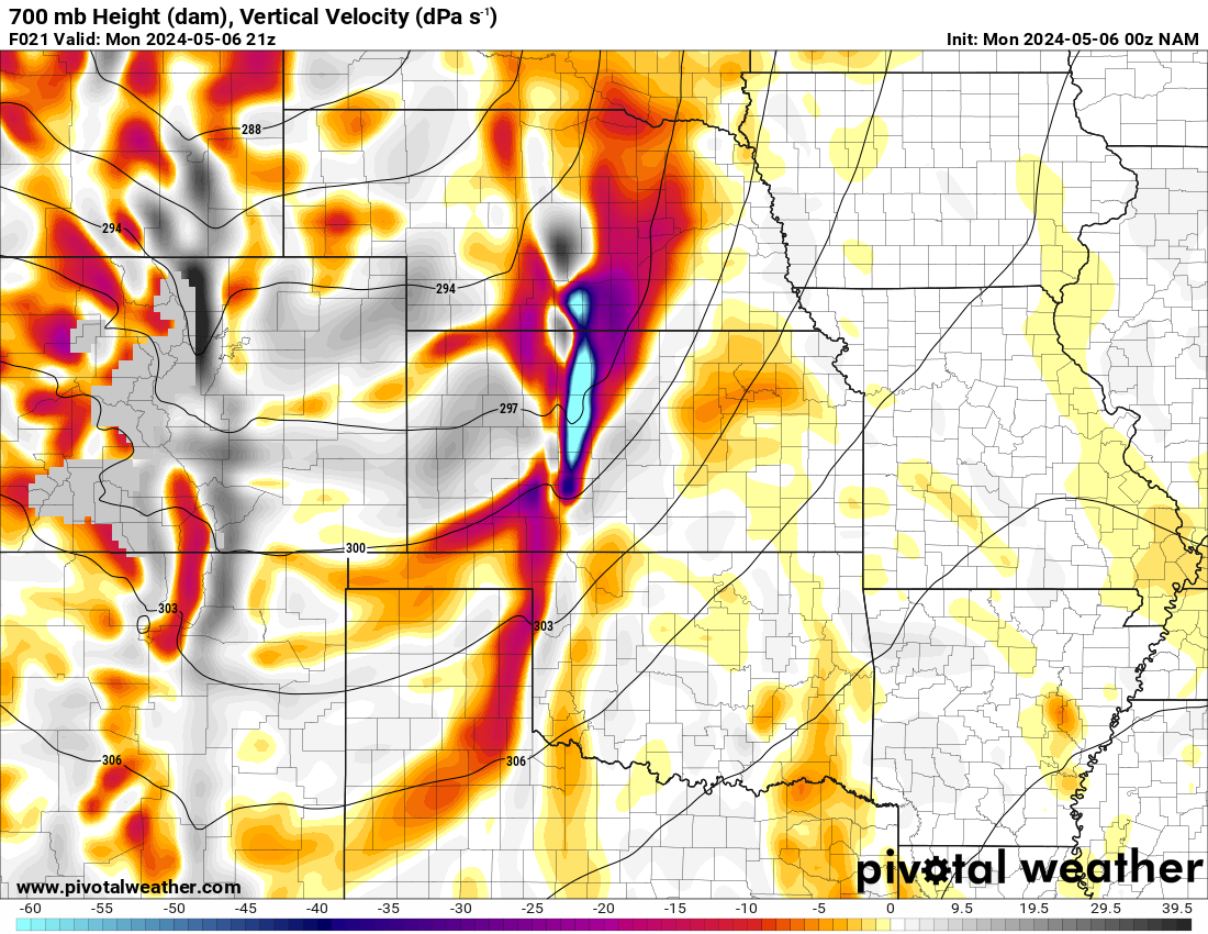
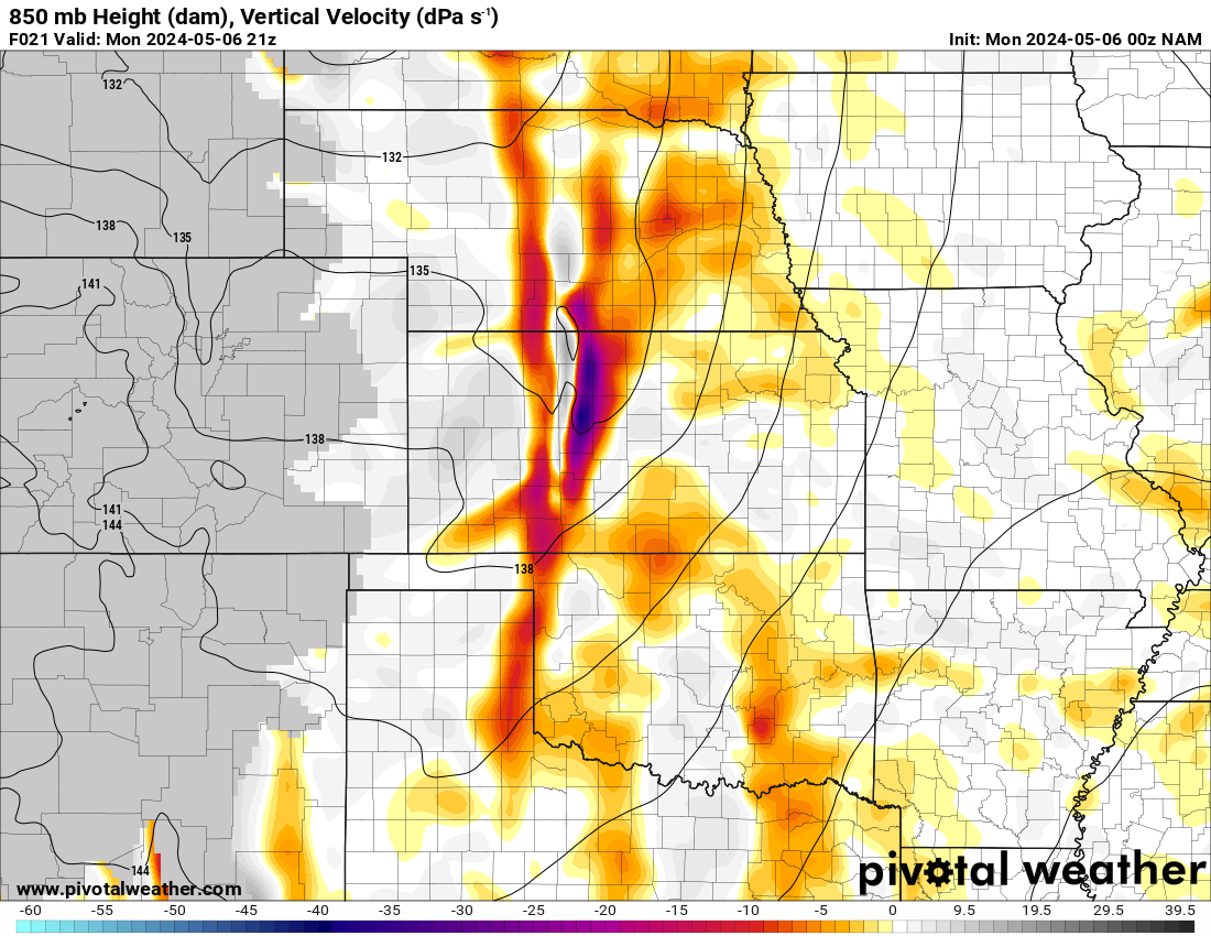
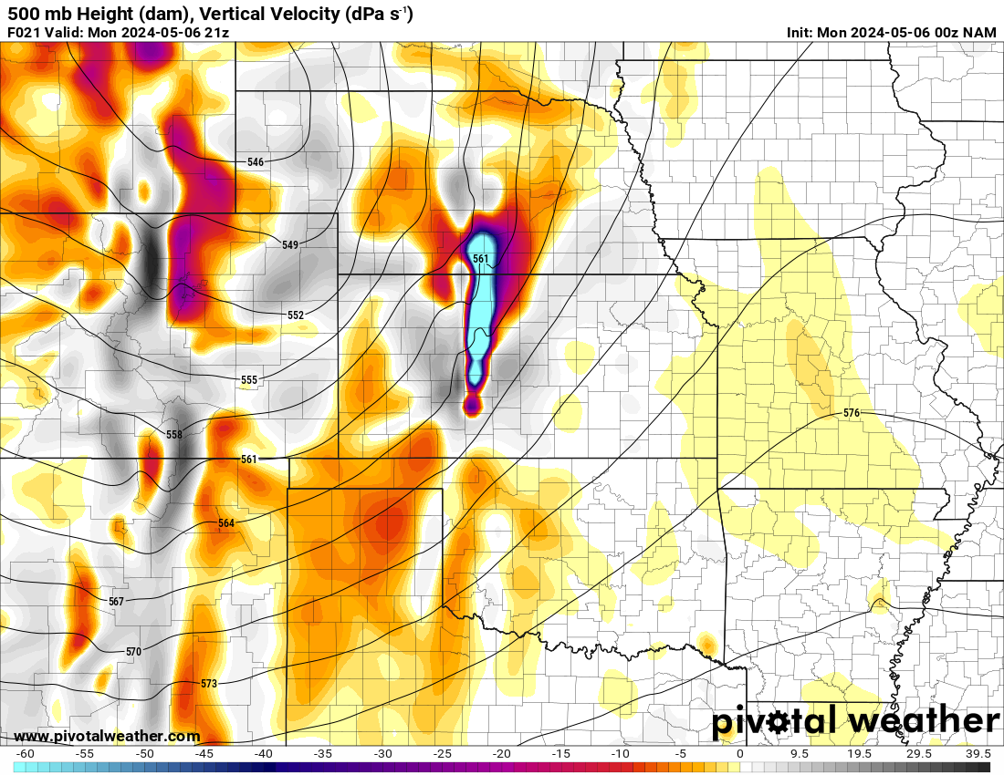
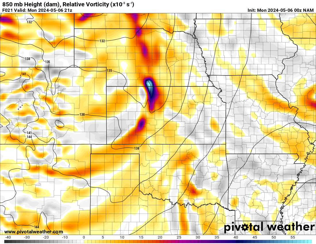
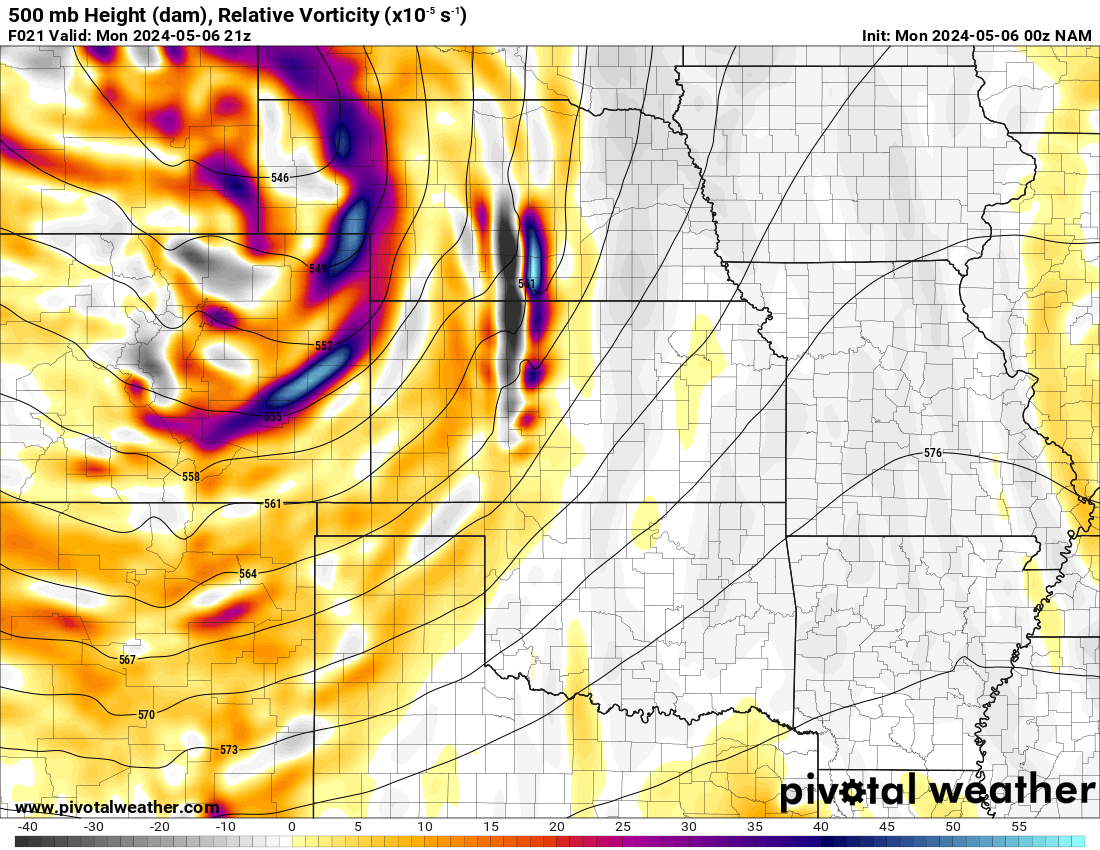
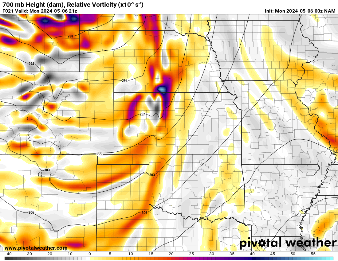
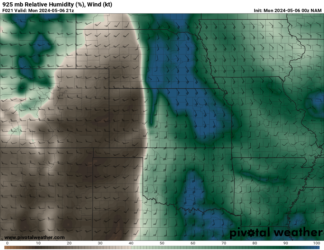
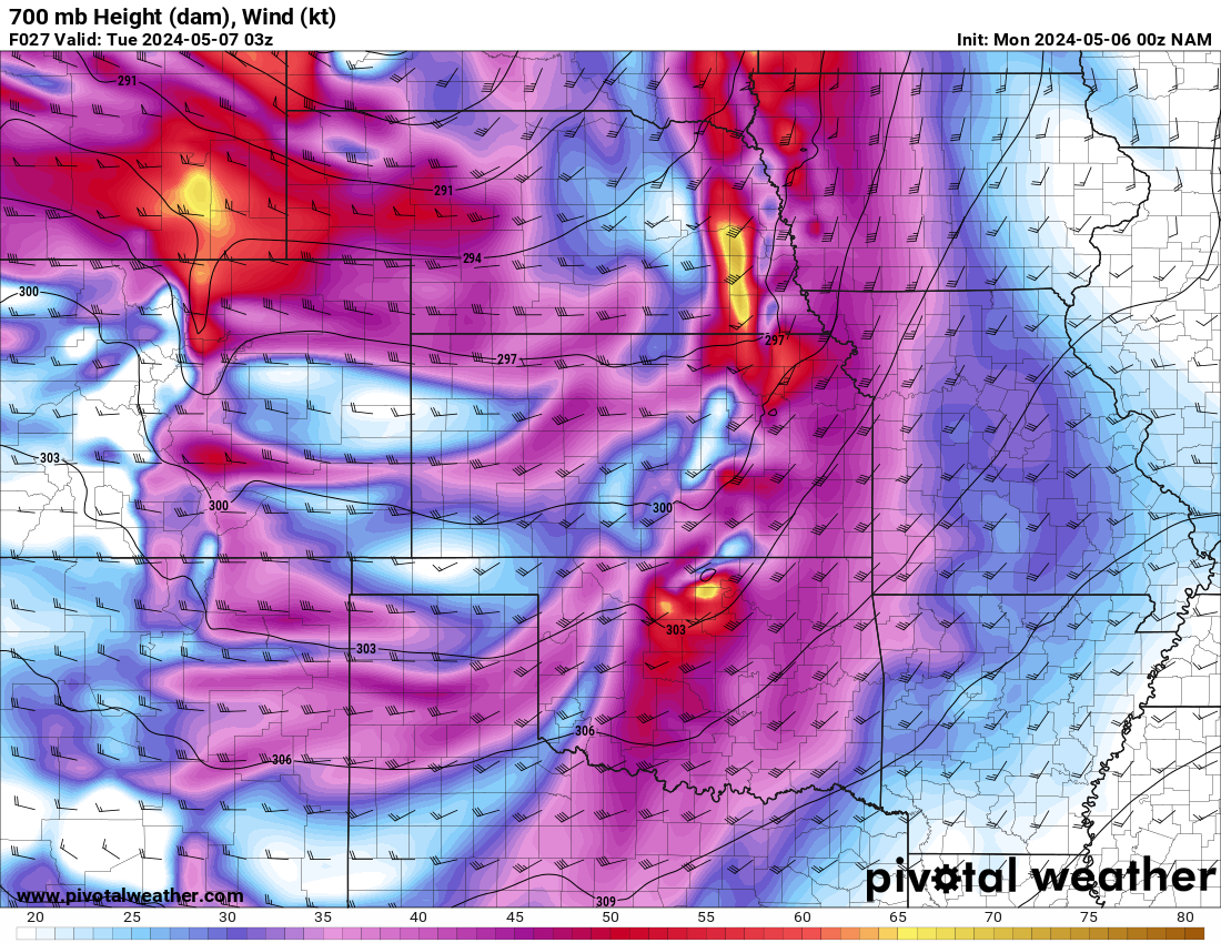
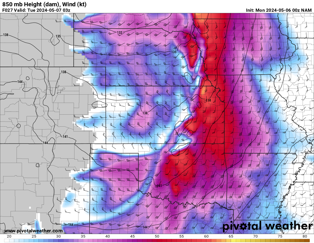
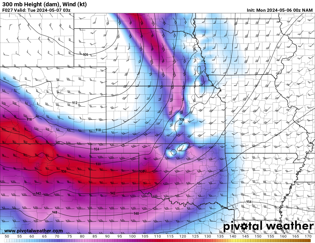
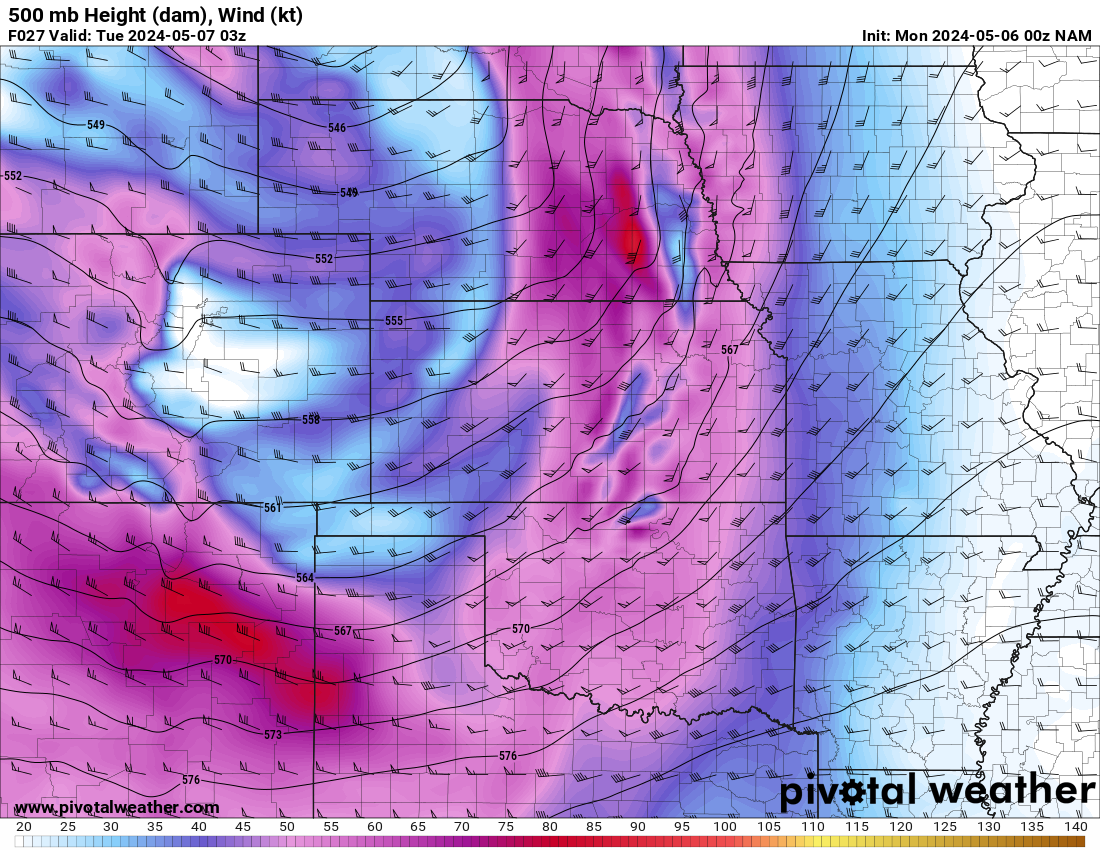
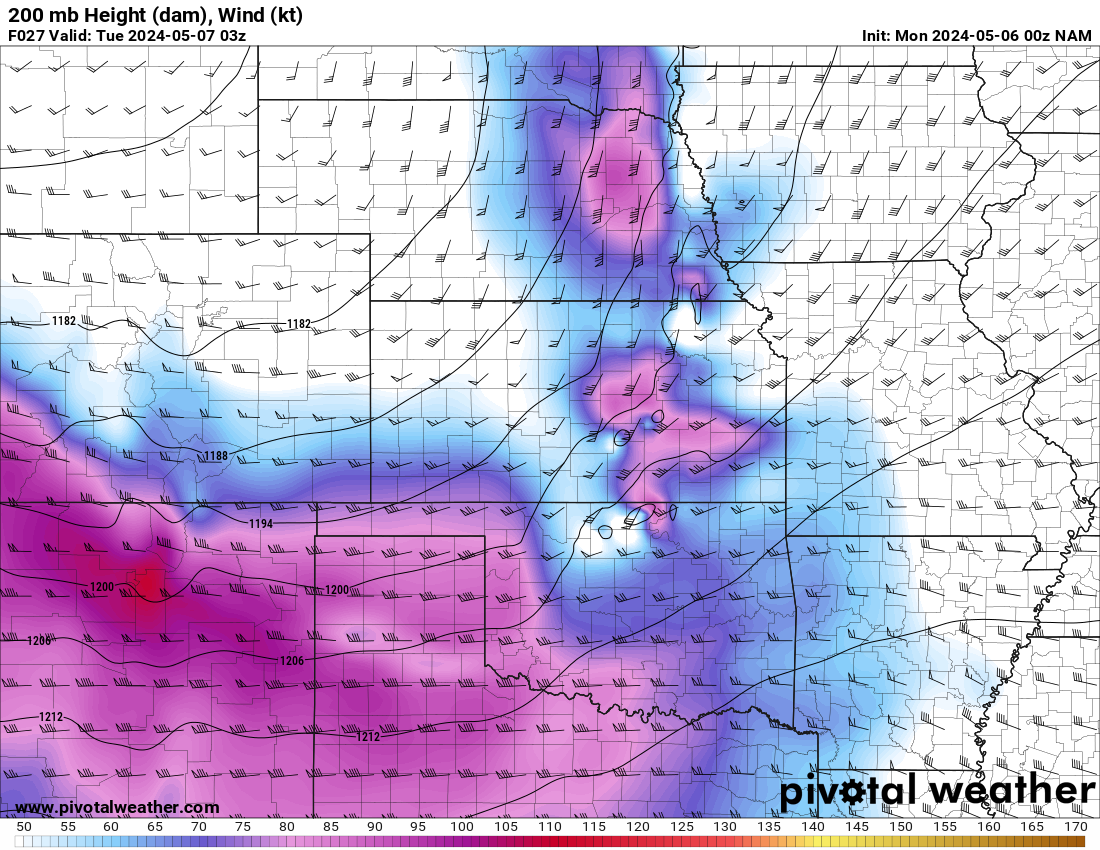
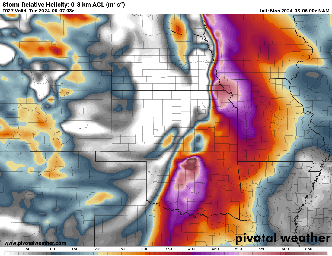
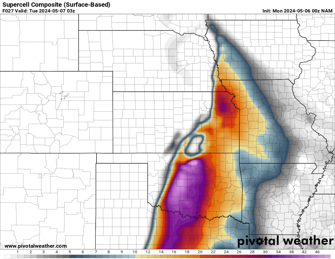
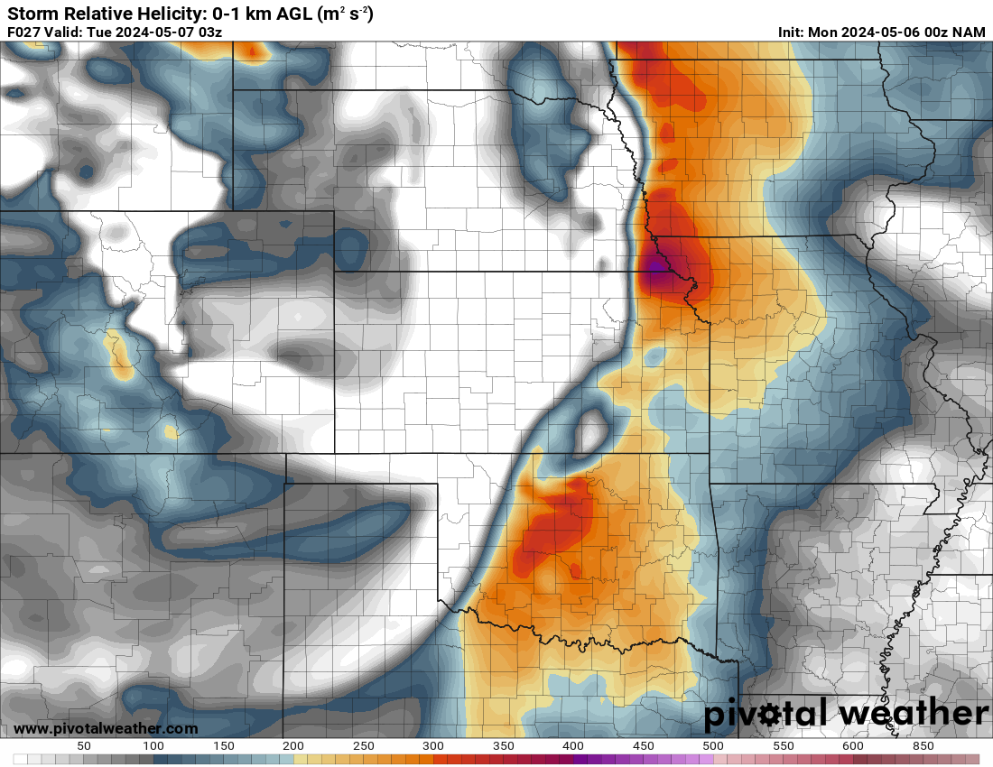
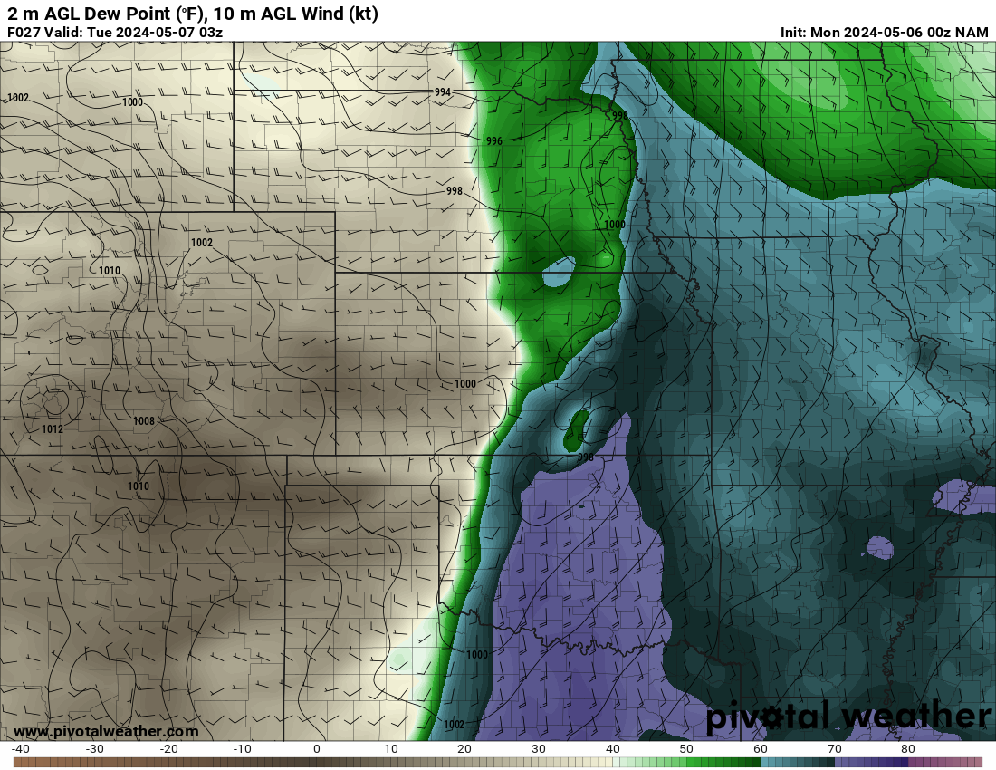
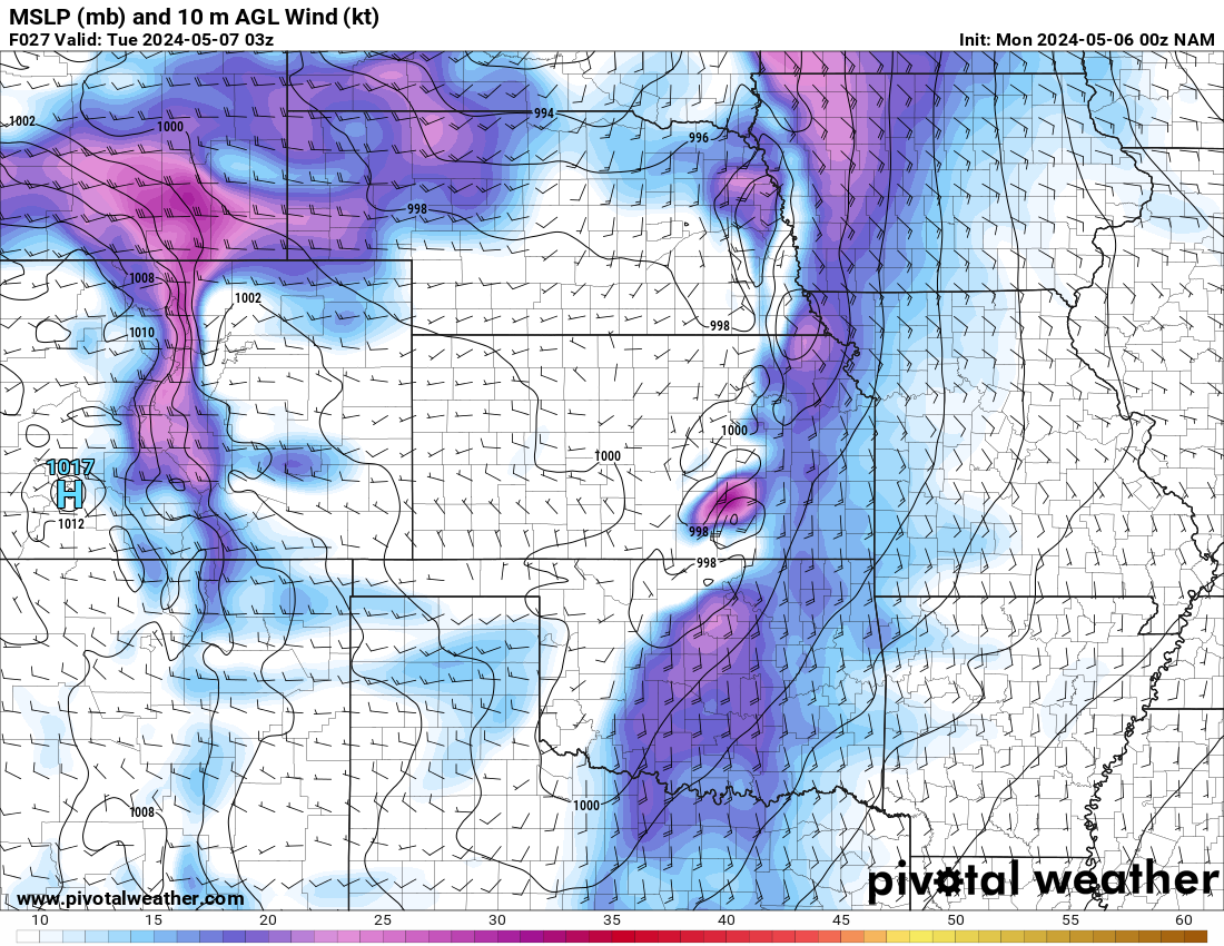
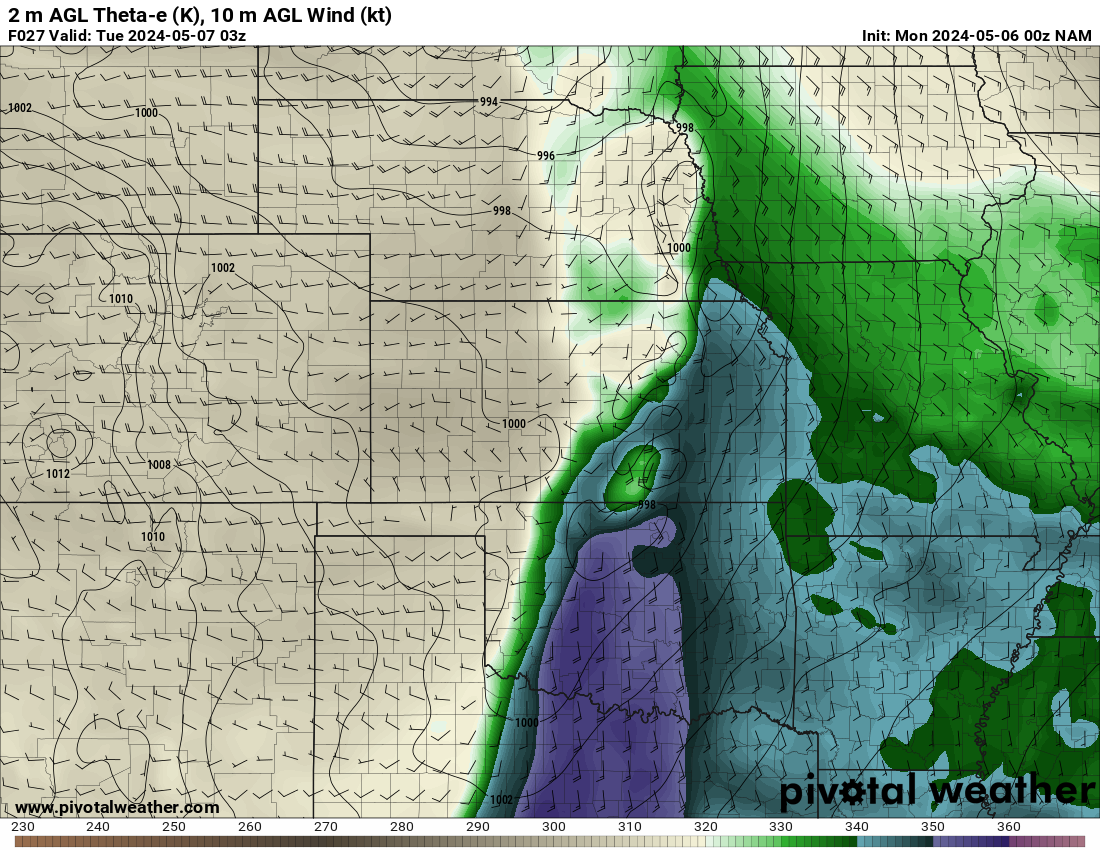
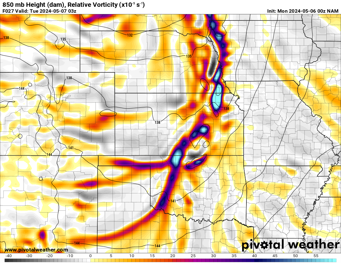
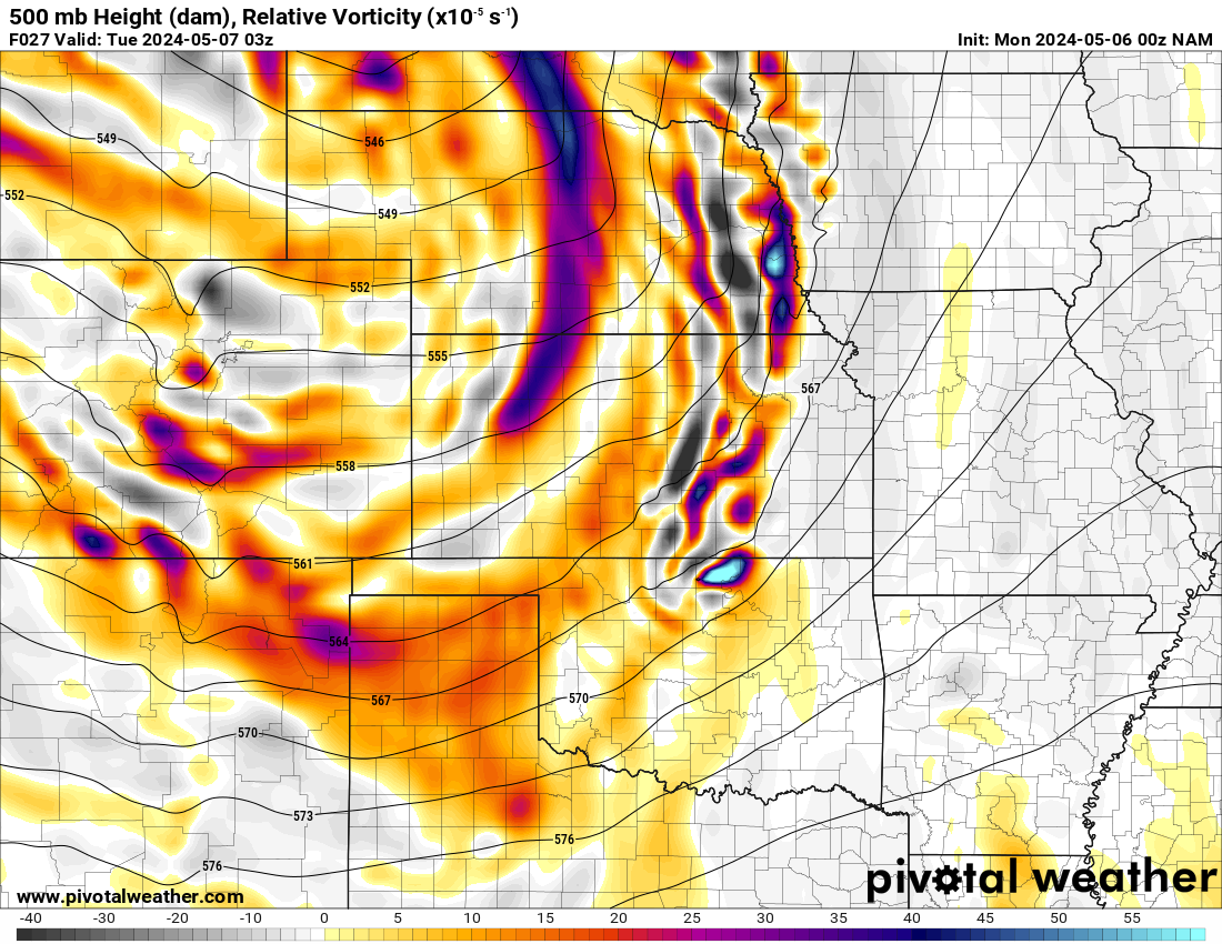
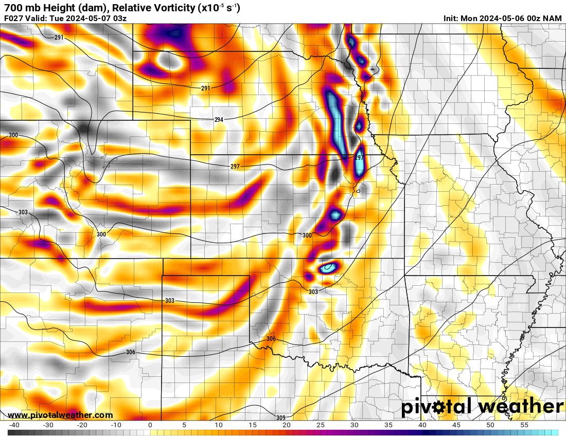
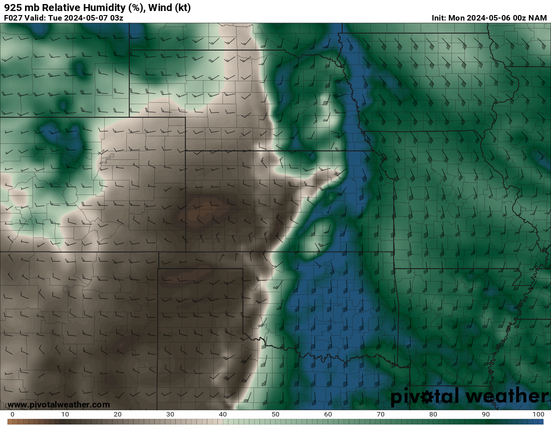
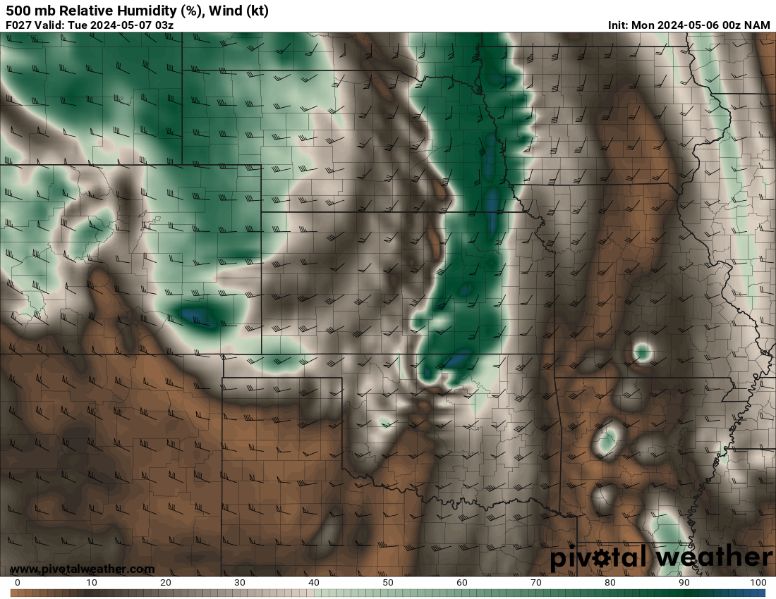
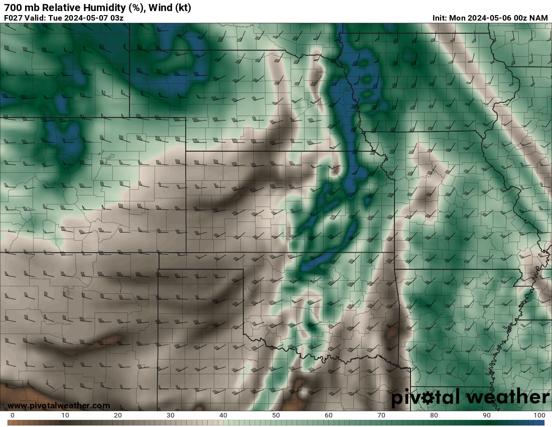
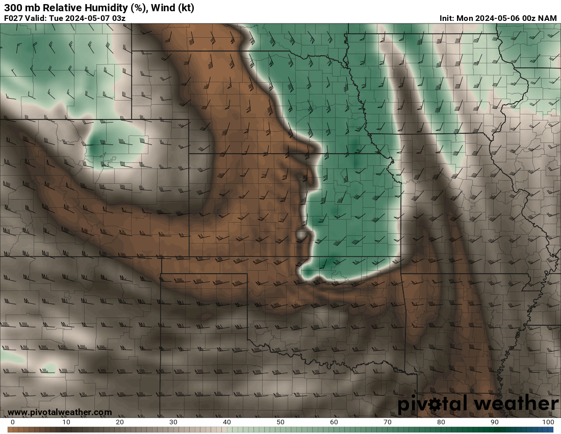
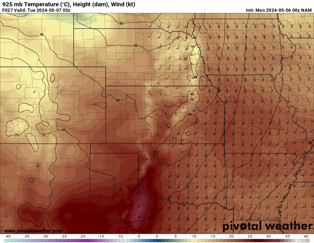
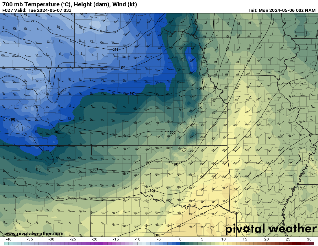
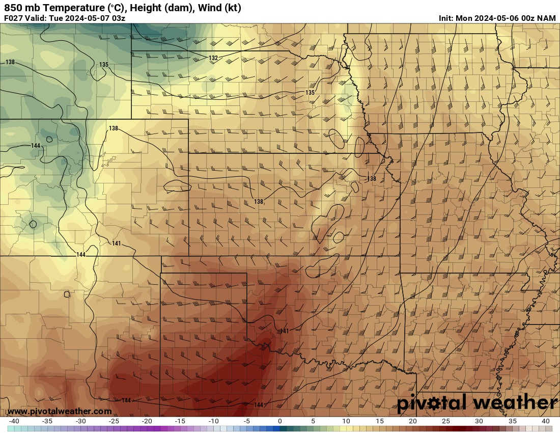
Sunday evening models/Monday 00Z
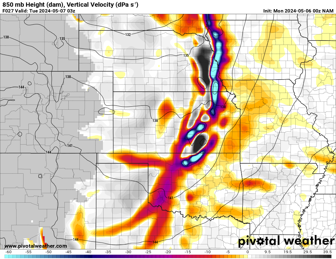
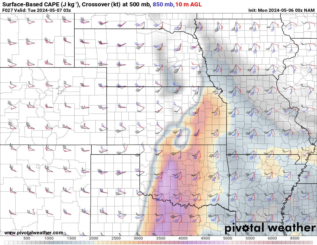
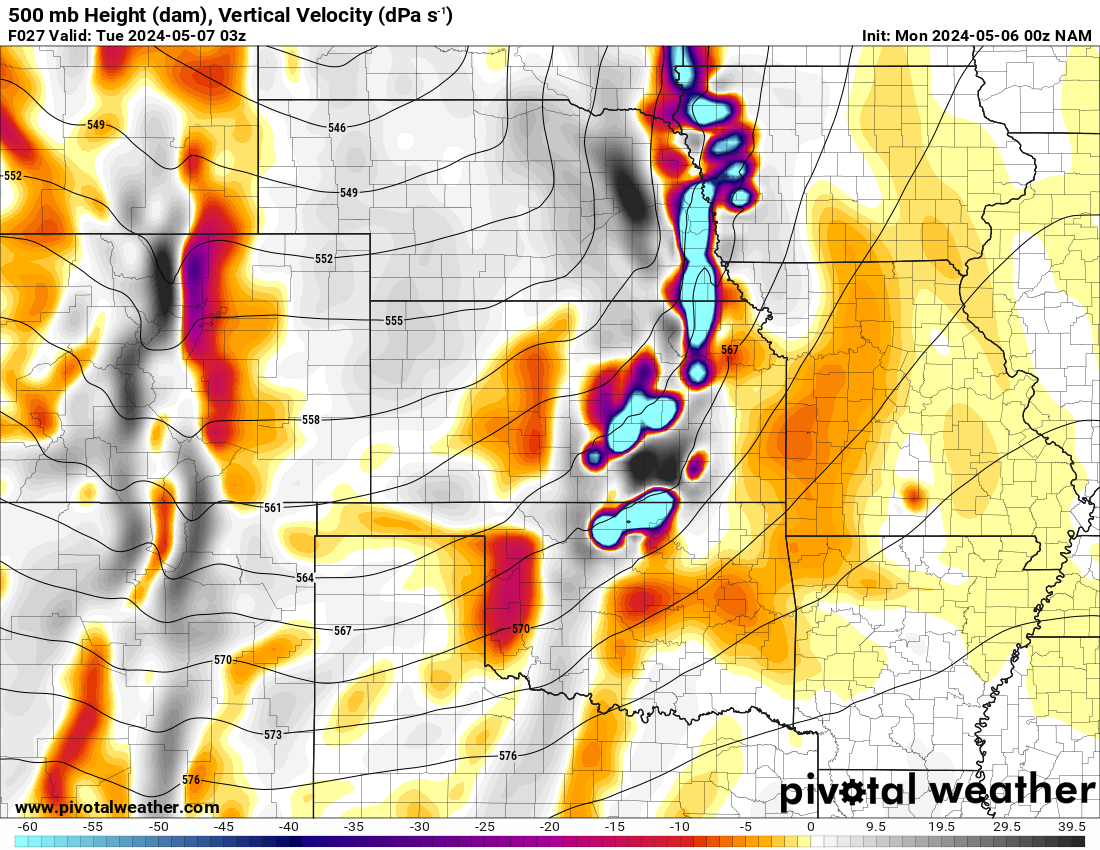
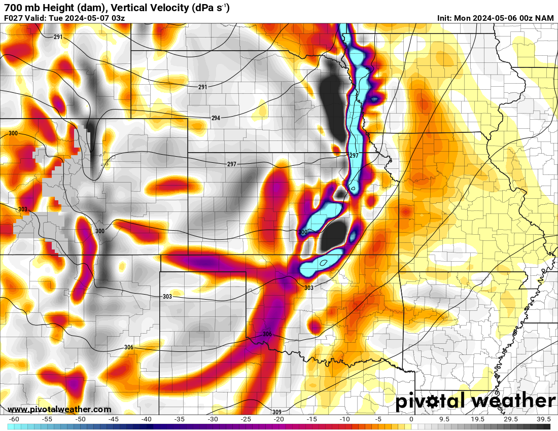
00Z NAM
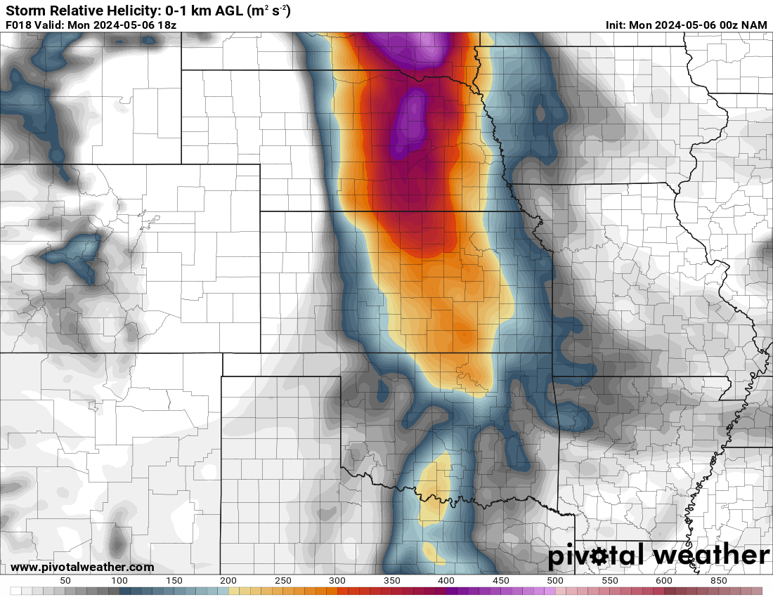
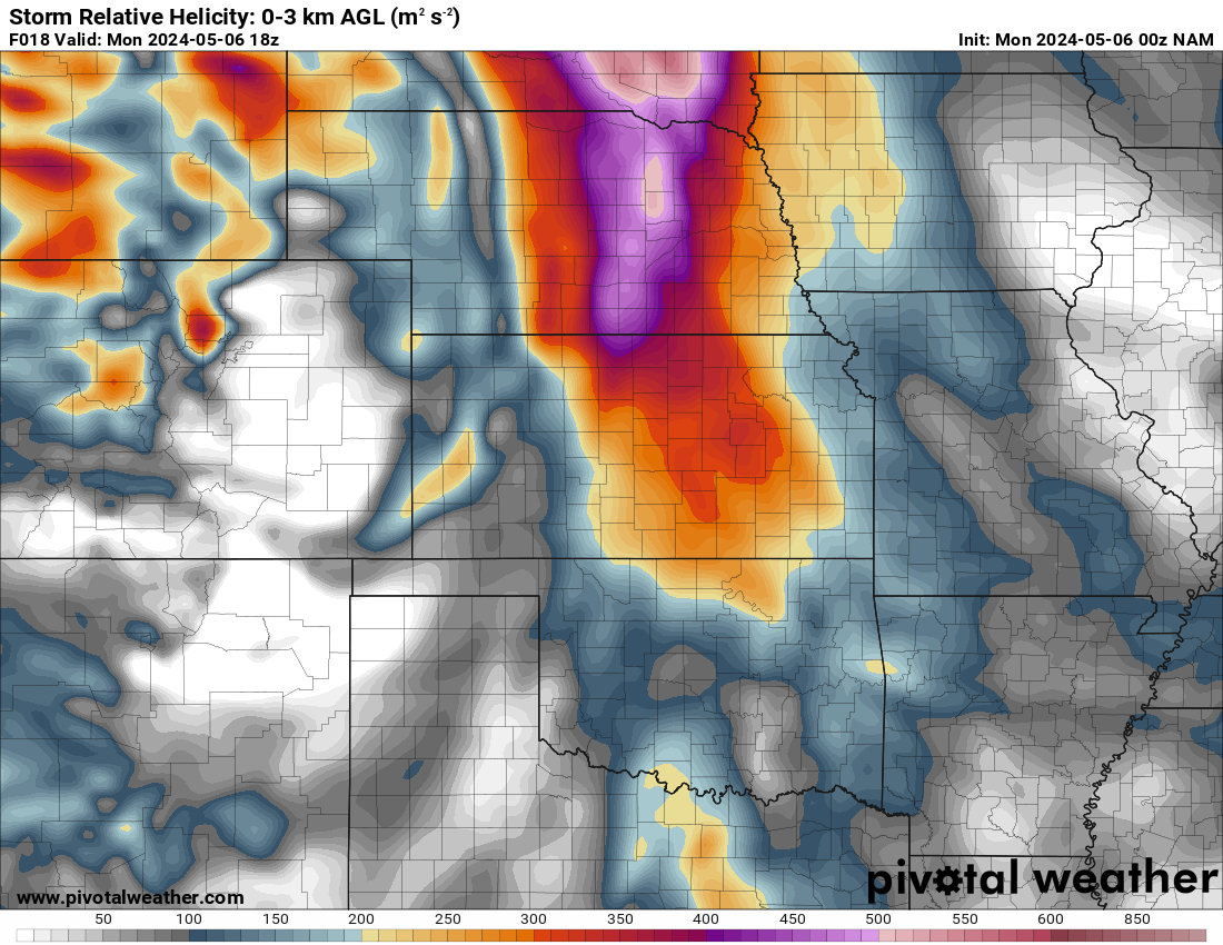
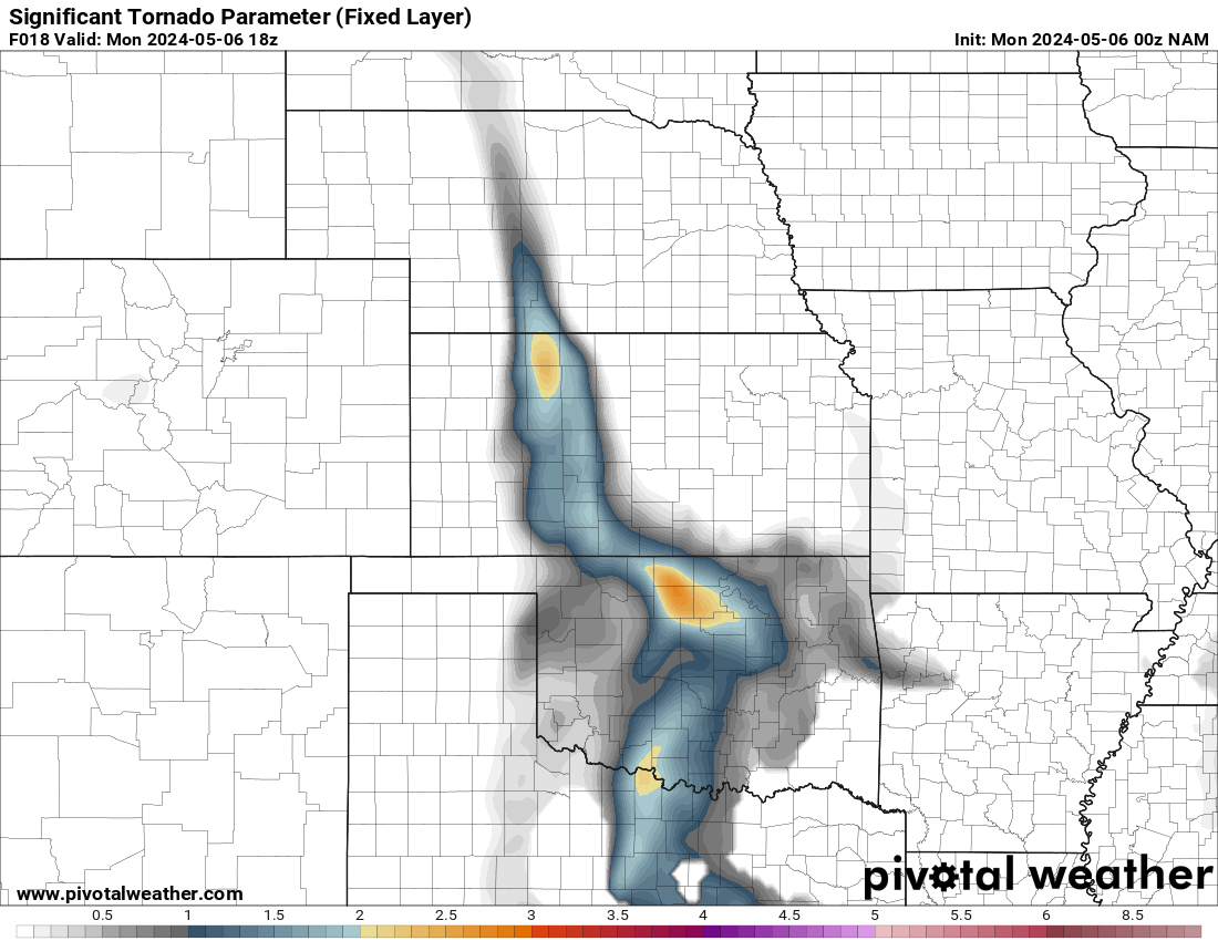
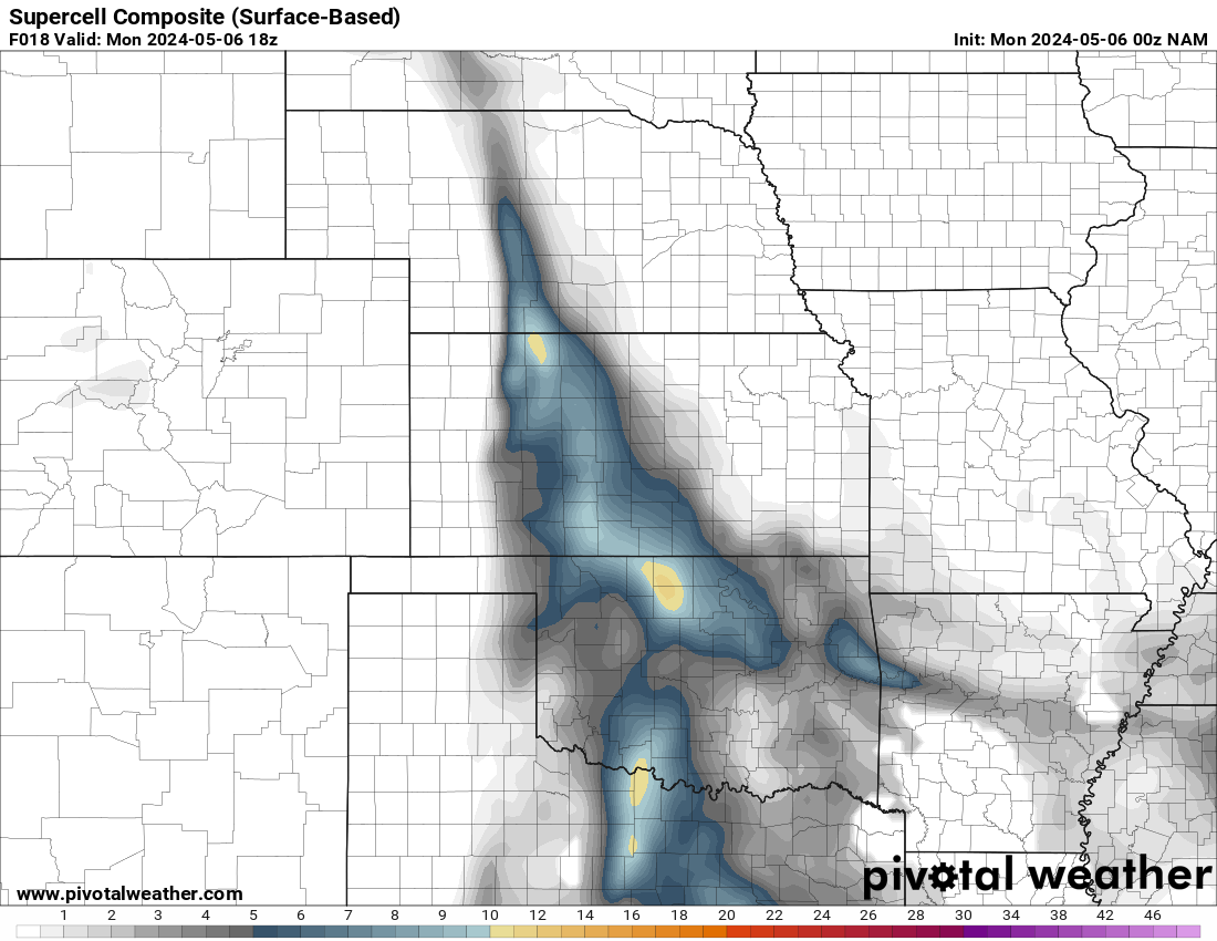


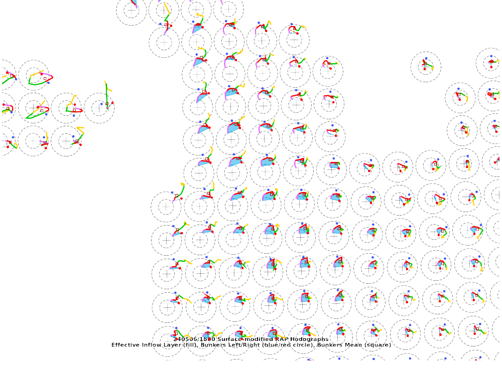
18Z Mesoanalysis and Water Vapor loop

Departure
Adam and I departed and headed to Weatherford where we got some lunch and hung out in a parking lot for awhile. We eventually would head west and get on the storm near Cheyenne. It had a decent wall cloud and the supercell was intensifying. Unfortunately, it was moving pretty fast as well. We stayed ahead of the storm as we tracked east to Putnam. That’s where we ran into the Canadian River.
Getting across the Canadian River and again the North Canadian River proved to be difficult. With storm motions and speeds, it made both inconvenient. We took OK-33 across the Canadian River near Thomas and then went up to Canton. Luckily we just missed out on the hail, but the largest report of the day fell there.
We continued east through Southard towards highway 8 where I turned north to Okeene. It was about this time I noticed that I was on the only storm without a tornado warning. The storm to our north was tornado warned, the storm to our southwest was tornado warned but my storm was severe warned for tennis balls and 60 mph winds.
Storm ramps up near Okeene
A tornado warning was issued. The storm had become quite HP in nature and was wrapped up. This video is of the RFD pushing around from the south. The vantage point was along highway 51 east of Okeene.
I bailed north off of highway 51 east of Okeene/south of Ames. I was trying to get a vantage point into the vault, but was never able to see as it was fully wrapped in rain. I didn’t trust dropping into the cage due to the high end parameters in place.
With as much precipitation that was falling, I went right back to highway 51 where we found tornado debris on the highway. I continued east to and through Hennessey. I headed north just east of Hennessey, back onto the dirt road grids. The RFD was surging, and the hook essentially collapsed. I started bailing east and found myself on an extremely minimum maintenance road. I don’t know how I managed to stay unstuck. Luckily, I was able to get to the next mile section of 2930 and bailed south a mile to Bison Road. Bison Road was a better road, and I started heading east again down Bison Road.
Turning North towards Douglas
As we continued east, we were finally able to get out of the precip and ahead of the storm. I took a road north into Douglas. From Flynn Road in Douglas, I was able to head east on a paved option. First, though, we needed to get a good look at the storms inflow.
Covington Oklahoma Tornado
As we got back to Flynn road, we headed east. It took me a moment to realize what was going on, but it seems like this might have been a satellite tornado to the bigger tornado. This was a right place, right time kind of deal, but we were able to get pretty close as seen in the video below.
Following storm into Perry
I headed north to 164 in Hayward, and followed that east to I-35 and into Perry. I went through Perry and met up with US64, which I took east.
Dropping South through Stillwater
As I continued east on 64, I eventually reached US177. I took this opportunity to start dropping south towards Stillwater and getting out of the storm. The storm was starting to line out as we came into Stillwater. The mission changed from storm chasing to getting out and going home.
It was getting dark and storms had become outflow dominant. I decided to call the chase and head back to I-35 south.
One more try?
As we were dropping south, the storm near Okarche was tornado warned and didn’t look bad on radar. I took a trip across Waterloo Road to OK-74. By the time I reached 74, it was obviously outflow dominant/linear and not capable of tornadic production. I dropped south through the city, coming down along 44/240 near the airport.
Storms were rapidly intensifying out west from near Hobart down to Altus. The decision was made to continue down 44 just in case. I ended up heading down to Chickasha before turning around and heading home.
Links
- My video of the Covington Oklahoma Tornado
- National Weather Service Norman write-up of the Covington Oklahoma Tornado
- Quincy Vagell’s Chase recap of the high risk in Oklahoma


